
Or, How Grate It Is – and Are There Any Valkyries Down There?

A signpost for the afterlife. Names of streets in this part of Clintonville were taken from Wagner’s Nordic opera. “Walhalla” is a variant of “Valhalla” – so watch for armored winged women if you’re among the valorous dead. (The loser dead “do not enter.”)
Walhalla Ravine: What happens to this urban micro-canyon…

…where deer do their best to ignore human pests… 
…trees walk up hillsides of (usually) pleasant woodland cottages… 
…and wildflowers tint the streamside as driveways arch over…
…when it hits the asphalt and concrete no-man’s-land of the High Street corridor?
But first: HOW did it get that NAME?!
Wikipedia notes that “the streets in the Walhalla Park Place section of Clintonville bear the legacy of Mathias Armbruster, a Bavarian immigrant who was fascinated with Norse mythology and Wagnerian opera…”
More from “Clintonville Street Names” in Clintonville History: “Walhalla was named by Mathias Armbruster, an immigrant from Bavaria and the first owner of the ravine (1859). In Norse mythology, Walhalla means ‘The Great Hall of Dead Warriors.’
“Other streets named for mythological characters include Brynhild (a queen of Iceland), Midgard (god of the earth), Mimring (god of water) and Gudrun (a Nordic princess).”
Wikipedia includes Druid Street in its list; my Celtic heritage feels slighted that Clintonville History has omitted it, if it belongs on the list. I wouldn’t know; I haven’t watched any Wagner…except for Bugs Bunny’s interpretation.
Maybe I can dig up that old animated ‘five-minute’ explanation, but I can’t find it on Youtube…
Meanwhile, Back at the Pavement

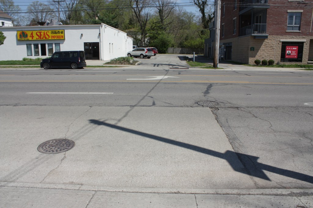
‘Neath this unassuming grate in the east edge of the High Street pavement between Weber and Walhalla streets is an underworld you might not expect…


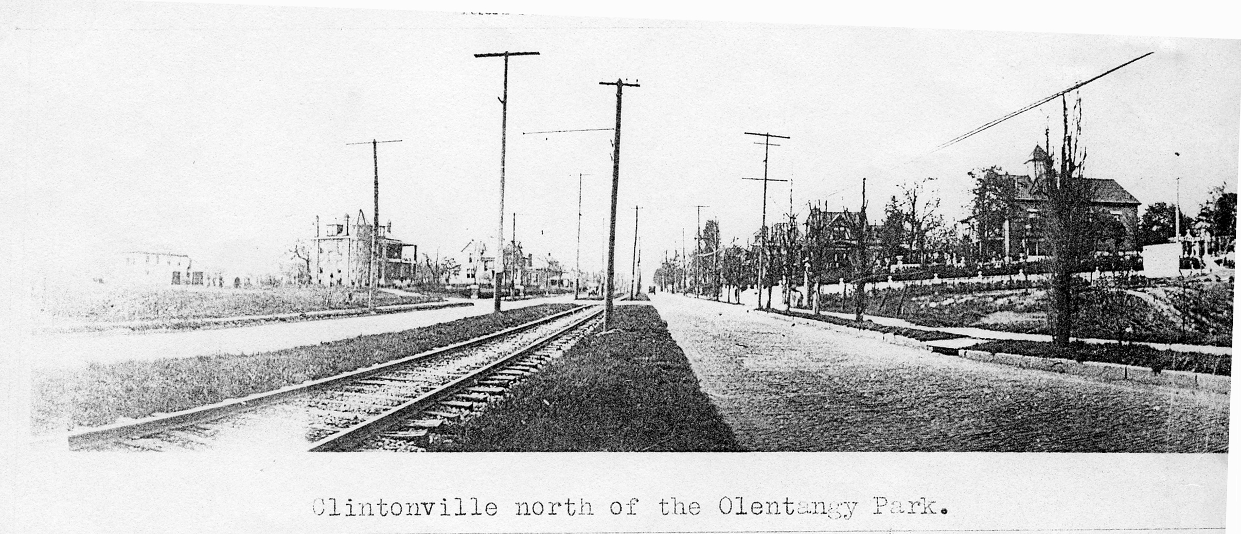
Curiously, a historical photo shows what appears to be a steel cover over this opening. Ooh…historical documentation of an underground thing that no one notices as they walk or drive over it…yummy. (There’s also a trolley or interurban line running down the center of a narrower divided High Street. If only…)

Poor thing. This is the best it will get for the next 1,500 feet.
It’s flowing to the west, to the right. The tunnel looks like rough unreinforced concrete, which would date it maybe from 1890 to WWI.
I can’t post videos here unless I pay for the privilege, so see my moving look into this dwarvish abode on my IHS Facebok page.
A Pearl Between Paradise and Peril

In the median on the left is a row of old stone curbing, lying flat. (Yes, that edge of the street a few inches tall must go down about three feet to be solidly anchored below the frost line in this climate.) The Walhalla culvert is buried deeply just to the left of the median.
And farther back, the wooden privacy fence separates Pearl Alley and this urban oblivion from the blunt end of Walhalla Ravine and its creek trickling through verdant slopes.

On the far side of High is a gravel parking area. In the distance, the tall grey trees are sycamores. More below on these two subjects.
To the left (south) is a recent low-rise apartment building, and to the right (north) an oriental food establishment. Keep these landmarks in mind for orientation.

Backing off from that view and moving north, Walhalla Road (do not enter!) crosses in the foreground, while this stub part of Pearl Alley begins here, runs south, and ends there at Weber Road. Its rise at the end is the top of the southern ravine wall, and points out the fill between there and where I’m standing.

Turning to the left / east (do not enter!), Walhalla Road rises out of its cozy ravine at the last house in paradise. Then I turn again to the left (north), and back out some…
Pray, Live, Die…Wait…

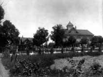
(Here’s a historical photo of about the same angle, though a small image.)

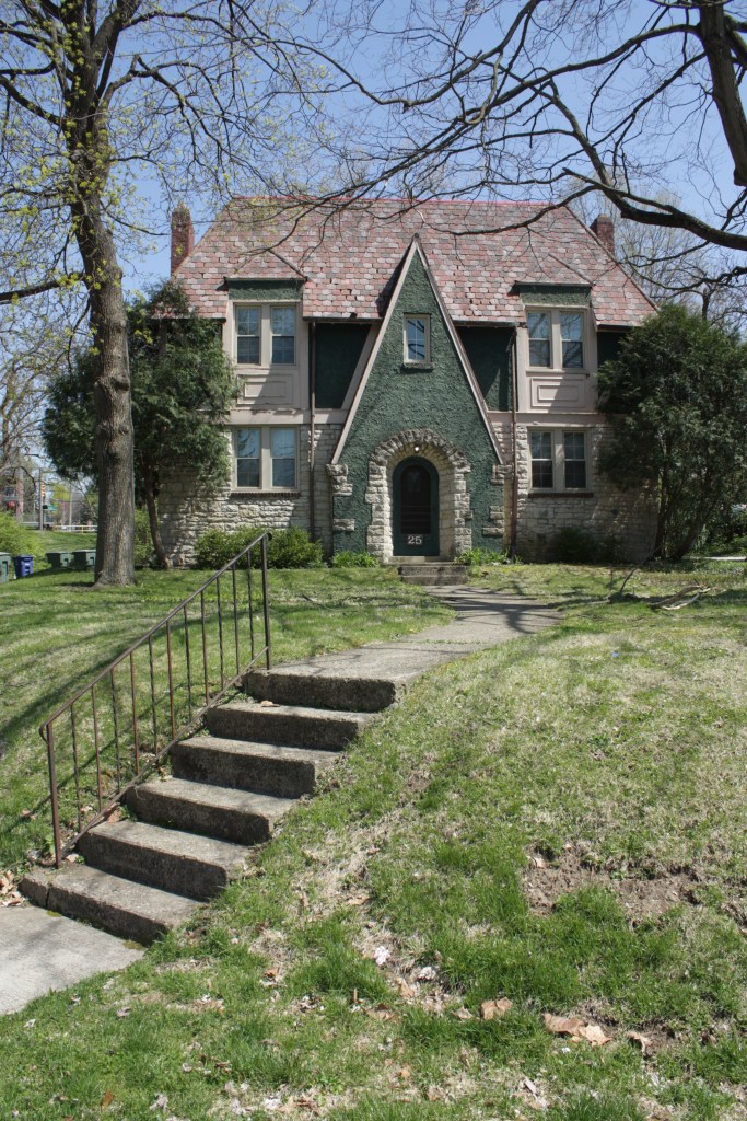
Originally a church (the gabled part in this view) used on the Underground Railroad, then a townhouse of a Wagnerian fan, it was last a funeral home…and has been vacant for a couple years in a town where anything under three stories is being systematically replaced with a low-rise that fills the lot.
This was Clinton Chapel. An entry in Shirley Hyatt’s Clintonville History reports:
“When Thomas Bull, one of Clintonville’s early settlers, died in 1823, he left land in his will to build a church for the members, and that church was erected 15 years later at 3100 North High Street near Walhalla Road & High Street. Southwick Good Fortkamp Funeral Chapel occupies that building today [or did].
“The church membership decided in 1881 to sell the chapel and move the church to the thriving community of North Columbus, and they built a new church on East Tompkins.”
In another entry:
“Alonson Bull and his brother Jason were abolitionists, Jason serving as a “conductor” on the Underground Railroad from Clinton Chapel at 3100 North High Street…
“Edward L. Sebring (1839?-1905) worked with Jason Bull to aid fugitive slaves escaping to freedom in Canada from Columbus, Franklin County, Ohio, to the next safe station.”
In yet another entry:
“Mathias Armbruster was born in Wurtenburg Germany in 1839 and came to the U.S.A. in 1858. He operated Armbruster Scenic Studios in Columbus—he painted scenic theatrical stage sets.
“Armbruster purchased the area around what is now known as Walhalla Ravine, and converted Clinton Chapel at 3100 North High Street into his private residence…[later the] Southwick-Good-Fortkamp funeral home…
“Mathias eventually sold most of the acreage to a real estate developer, and helped name the streets after his beloved Wagner Ring Operas. Mathias died in Columbus in 1920.”
Clintonville History has three photos of and from the house, including unfilled Walhalla Ravine. (Unfortunately, they’re small, but I think the author wants you to buy her book.)
Preservationists are worried about the fate of this site. From an August 2018 Urban Ohio forum:
“A children’s day-care center is being proposed for a shuttered Clintonville funeral home that preservation groups had listed as an endangered historic site. Plans for the former Southwick-Good & Fortkamp Funeral Chapel, 3100 N. High Street, will be discussed at the Clintonville Area Commission meeting…
“Mark Smith of CD Advisors, which represents the day-care operators, said the building would be renovated, but the historic structure would not be altered. … He said there is a lot of demand for a day care in the Clintonville area. Nearby residents were worried that apartments or condominiums would be built on the site near Walhalla Ravine.
“The building contains the Clinton Chapel, which dates to 1838 and was a stop on the Underground Railroad. In October 2017, Preservation Ohio listed the Clinton Chapel as among its most endangered sites in Ohio. The Columbus Landmarks Foundation also put the building on its most endangered list last year.”
The forum also includes a link to a Dispatch article with a nice interior photo over the lobby.
I haven’t found a follow-up article, but the on-site “for sale” sign states the 1.345 acre property has been sold.

Looking south from the mouth of Walhalla Road at High Street, we have the oriental food establishment and low-rise apartments flanking the buried stream. (The grate over the well is on this side of the pole with the transformer.)
Note the c1960 lightweight (but nice try) gatepost at the street corner – like many older pairs in southern Clintonville.
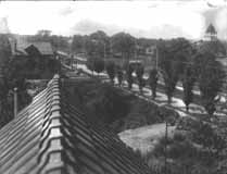
(Here’s a historical photo from a similar perspective – though from the chapel house’s rooftop – of the unfilled ravine…one of those small images.)
A Short Walk into Walhalla


Looking west, right behind the funeral home as the road rises up from the ravine, the shale wall of the ravine is exposed…beneath the former graveyard.
I’m betting the road was cut into the ravine’s hillside behind the funeral home (which exposed this shale) to allow the road to climb out of the ravine. The gully veers a little southward, where its stream heads to the fill next to High Street.

The creek flows to the south (left) of this house and into the culvert under the fence along Pearl Alley…until it empties into the Olentangy roughly 1,500 feet away.


I don’t know if the stream that flows through Walhalla Ravine and beside Walhalla Road is named “Walhalla” – or if it is a stream, run, creek, fork, branch, or whatever – so I’ll just refer to it as ‘Walhalla creek,’ sans capitalization of the second word.

Back at High Street, a view to the north shows the older commercial district of Clintonville that continues a little past East North Broadway.
(I believe East North Broadway was formerly just Broadway, but when the area was annexed into Columbus, it was overly renamed to avoid confusion with downtown’s Broad Street.)
Crossing Over
Back at at the grate, we look west across High Street to a manhole cover in-line with the culvert – but more likely is access to a sewer, electrical, or communications line buried above it. But beyond that, on the other side of the turn arrow…
…And looking back east, another manhole cover is in-line with the culvert. Again, with a good 15 feet or so of fill to spare, it’s probably entirely unconnected with the culvert.
Again, that historical photo of High Street shows a trolley or interurban line running down the center of a divided High Street with a power line on both sides of the tracks. These manhole covers may show where those wires were (thankfully) buried where they stood. (If only ALL overhead wires were buried…grrr.)
Another manhole cover is closer in my photo, in the concrete pad for a bus stop – yet another utility only hinted at from above. But behind us…

This is typical when a sewer line runs through a lowland, but is inexplicable here…except as an access to the covered-over culvert of Walhalla creek, where additional fill is anticipated. (Yay! Make flat Columbus more flat!)
In the distance is the unfilled continuation of the ravine, with brick buildings visible on its north (right) side.

Looking east up the slope, the projecting manhole is on the left of the left-of-center bigger tree, at the back of the white car. In the distance is the top of the low-rise apartment building on High at Weber.

Below that, looking west and downstream, is the continuation of the ravine, filled with a gravel parking lot cul-de-sac on the valley floor and flanked by brick apartments.

Looking east, that white car at the projecting manhole near the top of the fill is near the center of the view.
Living in the Dry Ravine
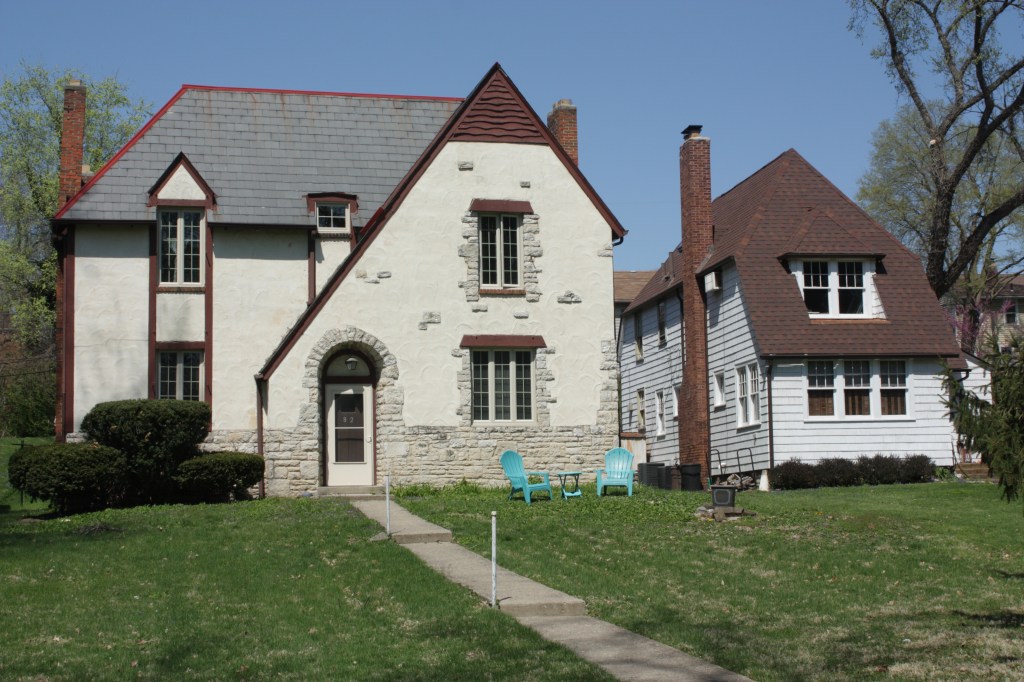
Some of the most facetiously cute quad apartment buildings are along this domesticated part of Walhalla Ravine. (Note Weber and High in the left background.).
That dark green paint is probably “Hunter Green,” named after Chillicothe’s Dard Hunter I, who popularized that shade during the Arts & Crafts movement of the first part of the 20th century.


(Unless someone uses this grass as a golf course, football pitch, or volleyball court, it’s a total waste of a tortured monoculture.)

Giant ghosts of the floodplain, sycamores prefer deep soils with plenty of moisture. Their happy presence in Walhalla Ravine Extended – even if planted, and not wild seedlings – reminds us that this was and remains a stream channel.


And this is a good split level – a “tri-level,” the Best New House Type of the 20th Century. (Those bi-levels are just stupid, and are the Worst New House Type of the 20th Century.)


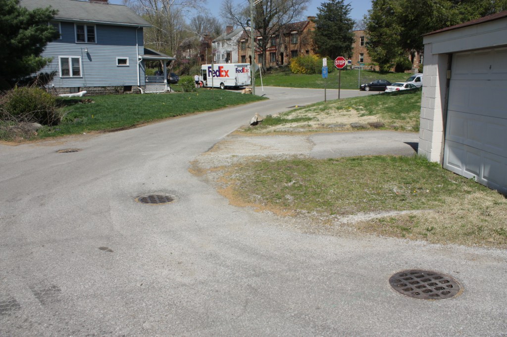
(In the background is a FedEx man looking to deliver to “Tony Stank.” But he happens to be parked in Walhalla, so he really should be asking for Thor…before Loki slinks out of a drain hole and complicates matters…)
Into THE Village

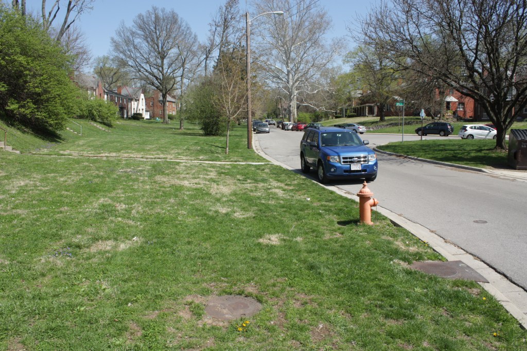
Hopping over the fence (no, I wouldn’t…not in plain sight in daylight, at least – I took the long walk around), looking southwest and downstream on Sunset Drive.
A storm sewer drain implies one side of the route of the almost unlocatable buried stream. It probably runs under the garages, towards the radio broadcast antenna. But, the divot in the middle of the road may be recent repair fill re-settling atop the culvert.

Looking back, northeast to Tulane, the culvert runs toward us under Tulane between the red brick apartments and the white split level house, then under the black asphalt of Sunset Drive to where I am standing with the garages at my back.
We’re on the low terrace, one step above the floodplain, and the ravine has ended. The orange brick apartments in the distance are atop the far side of mouth the little valley of Walhalla creek.

On the other side of the nicely sterile, pasty white vinyl-sided grey-roofed garages (sort of like a row of storm troopers?), I believe the buried stream runs out from under them and past the drain in the middle of the asphalt – causing cracks along the way.
This “Sunset Cove” is part of newer additions to the Olentangy Village complex, probably less than 15 years old – so the fill and graded earth it’s built on may still be settling. A culvert even ten feet down could still cause enough differential settling to reveal its location.
What’s in the drain? “I don’t care what you do with me, Br’er Fox. Just don’t ask me to look in that hole over there. Roast me, Br’er Fox, but don’t ask me to look in that hole,” said Br’er Rabbit. (Br’er Fox gives Br’er Rabbit an absurd interest in subterranea and a camera, and says “Yoah gonna do worse than thayat!”) …

I think there’s a more subtle culvert opening in the lower left. I doubt they would have built this drain over, and saddling directly into, Walhalla creek: side feeds are usually routed indirectly from the side. But they may have been more direct here, and so Walhalla creek may flow right through this pit.


Looking from the Village gate to the Trail… 
…and from the Trail to the Village – with a very selfish sign, probably because of rude people.
From Ravine into River

Looking northwest from the rec trail bridge over the Olentangy, a hotel and another radio broadcast antenna are upstream. In the distance is that mirrored-window medical building north of West North Broadway, I think.

But what’s that dark opening in the center, like a portal to the hall of the dead?…


Back to dry land and the forlorn, lost Walhalla creek: tracing its vector from the asphalt parking lot drain leads to, below the bridge and dam, a riverbank warning…


Soon, part two: From High to Indianola – Walhalla in the open, a murdering madman’s mansion, a trio of deer and of owlets and of shales, pricey properties, white bluebells, a respite from FLATlumbus, “what’s under THAT manhole?”…and more!

And a sideline: “Olentangy Village – Pleasant but Stale Colonial Re-Re-Re-Revival Architecture…and Getting Staler.
Ikke verdens ende…

One thought on “A Well into Walhalla – Seeking the Rest of Clintonville’s Ravine (Walhalla part 1)”