450,000,000 Years of South Central Ohio Heritage in Word, Image, and Action
Posted on
Wending Through Walhalla – Exploring Clintonville’s Paradise Ravine (Walhalla Part 2)
Or, Walhalla Uncovered – As It Should Be…Unlike in Part 1.
After six photo explorations, I have gone both ways through the lost and found, hidden and visible, watered and piped ravine, finding its beginning and end between I-71 and the Olentangy River.
In part one, I showed how I happened across a grilled-over well-like shaft at the edge of High Street to see Walhalla’s stream flowing deep beneath.
That took me downstream in a ravine devoid of the stream (tunnelized under West Tulane) until I reached the stream’s outlet behind Olentangy Village (itself the subject of a sideline blog).
At High Street, I peeked into the ravine proper before backing out and looking briefly at former Clinton Chapel at the street’s mouth (yet another possible sideline blog). So here, I’ll travel deeper into the Paradisiacal Vale of the Great Hall of Dead Warriors.
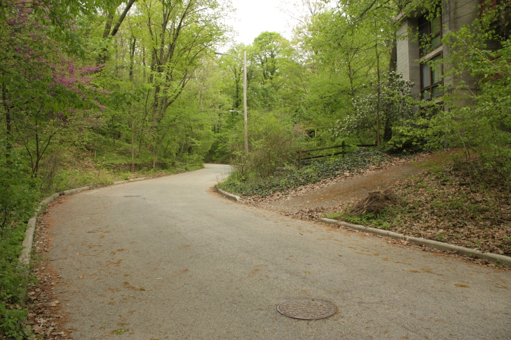
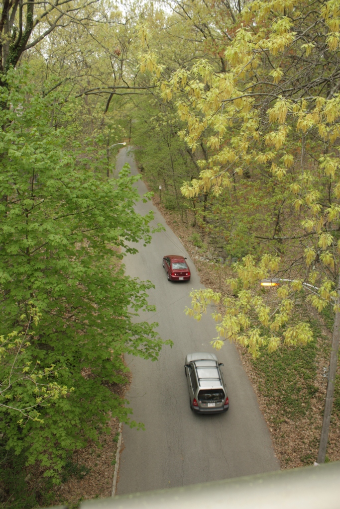
We’re back into the ravine, but going the wrong way – so if you’re driving and following my blog, be sure to turn your smart phone or tablet around. ; )
(However, the street is heavily traveled by pedestrians, dog walkers, joggers, cyclists, and avocational naturalists, who are allowed to go both ways…unlike the infernal combustion prison-cells-on-wheels.)
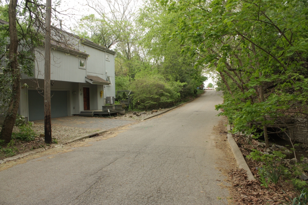
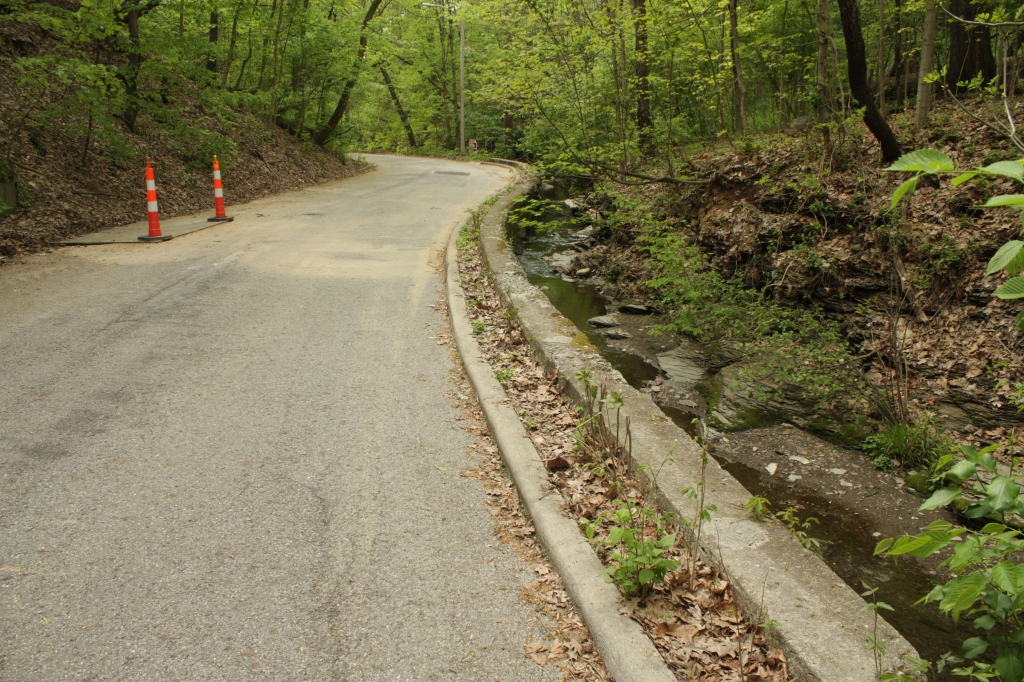
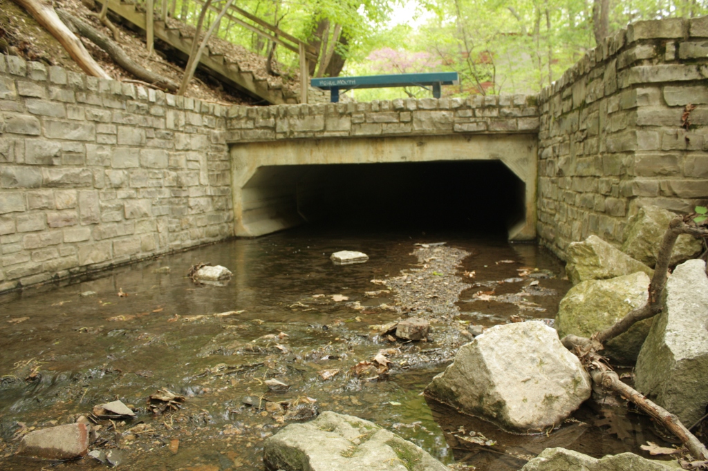
Here at the last culvert crossing under the road, is the second of the three last houses on the street – recent modernistic-styled residences sitting on the road within the ravine, instead of perching atop the ravine walls. (This culvert is also featured in part one.)
“Recent” meaning 1980s: from High Street, 1981, 1980, 1987, as noted in the Franklin County Auditor’s web data.
Looking west to the far end of the tunnel of trees is a white and red building on the opposite side of where the street ends at High Street – overexposed in its lack of tree cover in contrast to verdant Walhalla.
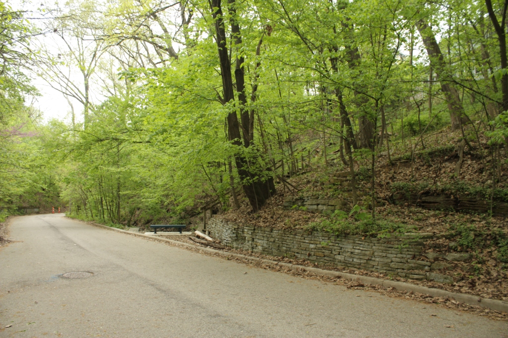
Now looking and moving east, we’re soon at a pinch-point where the valley narrows and the stream is forced over to one side against the bedrock and glacial till valley wall. Understandably, it’s not happy, and has to be restrained by a retaining wall to prevent angrily washing out the road…which it has probably done in the past.
See? This is why you leave pretty little streams alone in their pretty little valleys. Like wild animals, they’re best left wild and appreciated in their natural context, so they don’t have to turn against you when pushed to their limits (and then executed because of stupid humans).
But yes, as Frank Lloyd Wright said about placing his “Fallingwater” house on top of its stream: If you could see it all the time, it wouldn’t stay special.
Then again, the familiarity of zipping by at 25 miles an hour might breed complacency and contempt here…but hopefully not for the pedestrians.
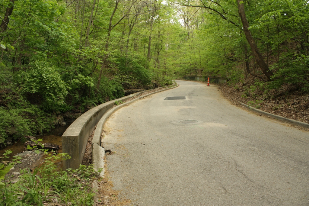
In the center of the road is another manhole cover to the sewer line under the road, and an asphalt patch beyond that. A little farther beyond is a small footbridge over the stream, discussed below. And past that and the orange cone is a concrete retaining wall where the road cuts into the steep slope below Weber Road, also below. Here’s the shallowly arched concrete slab footbridge over the stream, leading to a series of steps up the slope to one of many houses overlooking the ravine from its top edge. In this case, the 1927 Dutch Colonial backs up to California Avenue. Beside that footbridge, straddling the lot line, are two exotic ornamental plants that fooled me at first.
On the left I thought the huge overarching yews were native hemlock, descendants of those herded slowly southward by the glaciers multiple times over the last one to two million years. On the right, I thought the…I’m still not sure what it is…arching over the bank, was the prickly invasive multiflora rose.
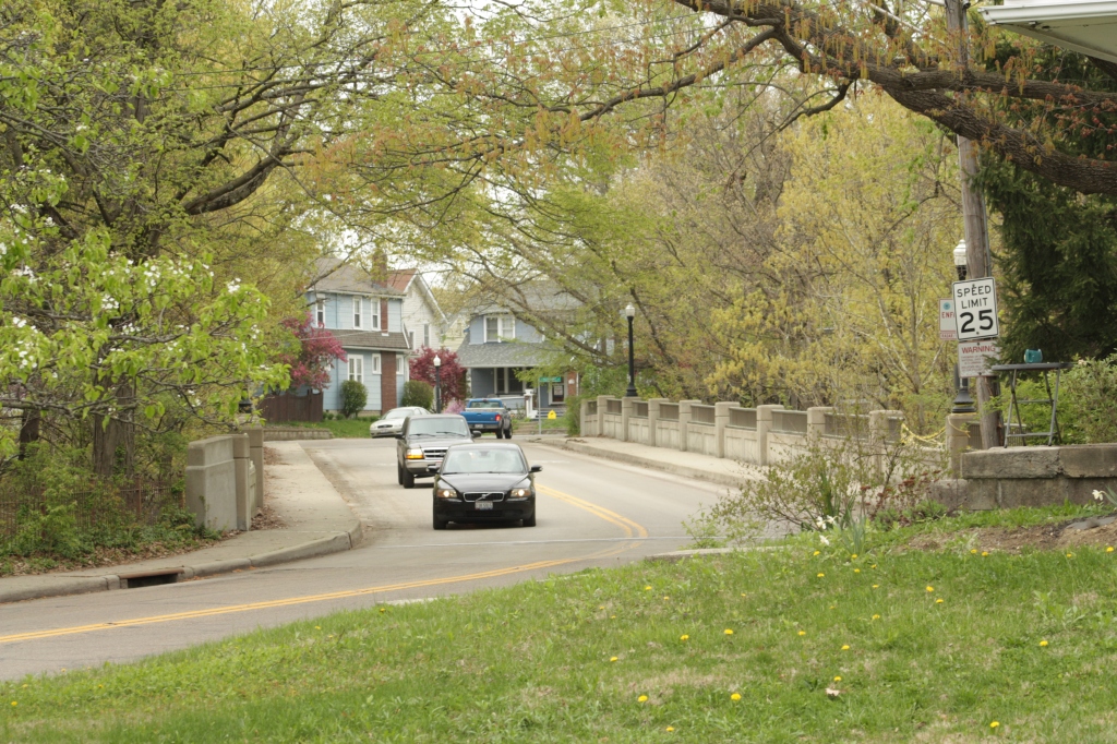
A sign shows the neighboring lot will soon be for sale: Homebuyers, here’s a couple unusual plant features possibly included with your piece of the ravine! Continuing east, we reach the point where Walhalla and Weber try to touch, but never will, like Romeo and Juliet at their balcony. Walhalla on the ground gets a masculine retaining wall, while Weber leans over a feminine balustraded railing.
However, the Department of Water has dug a hole in the pavement and so the tragedy of the star-crossed streets has been delayed due to construction.
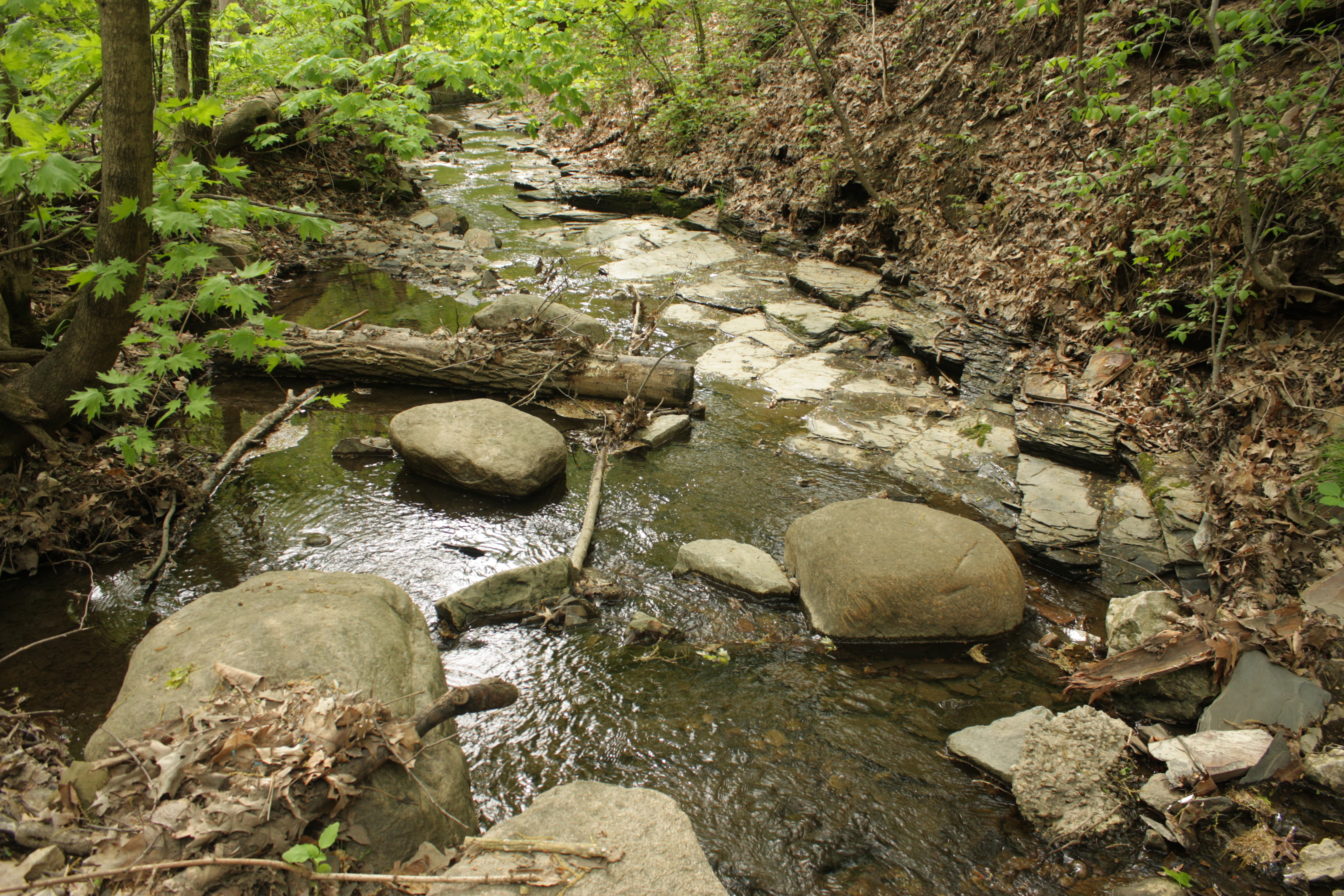
Looking back to the west, the stream continues babbling…or maybe grumbling…against the retaining wall. But its bed is widening now, so it has less to complain about. (Or rather, it’s narrowing, since we’re going upstream…but let’s keep the narrative simple.) And here is its bed: A pleasant one, with glacial erratic boulders hauled by arctic ice from Canada, and shale bedrock pavement with rectilinear cracking from crustal warping in the distant past.
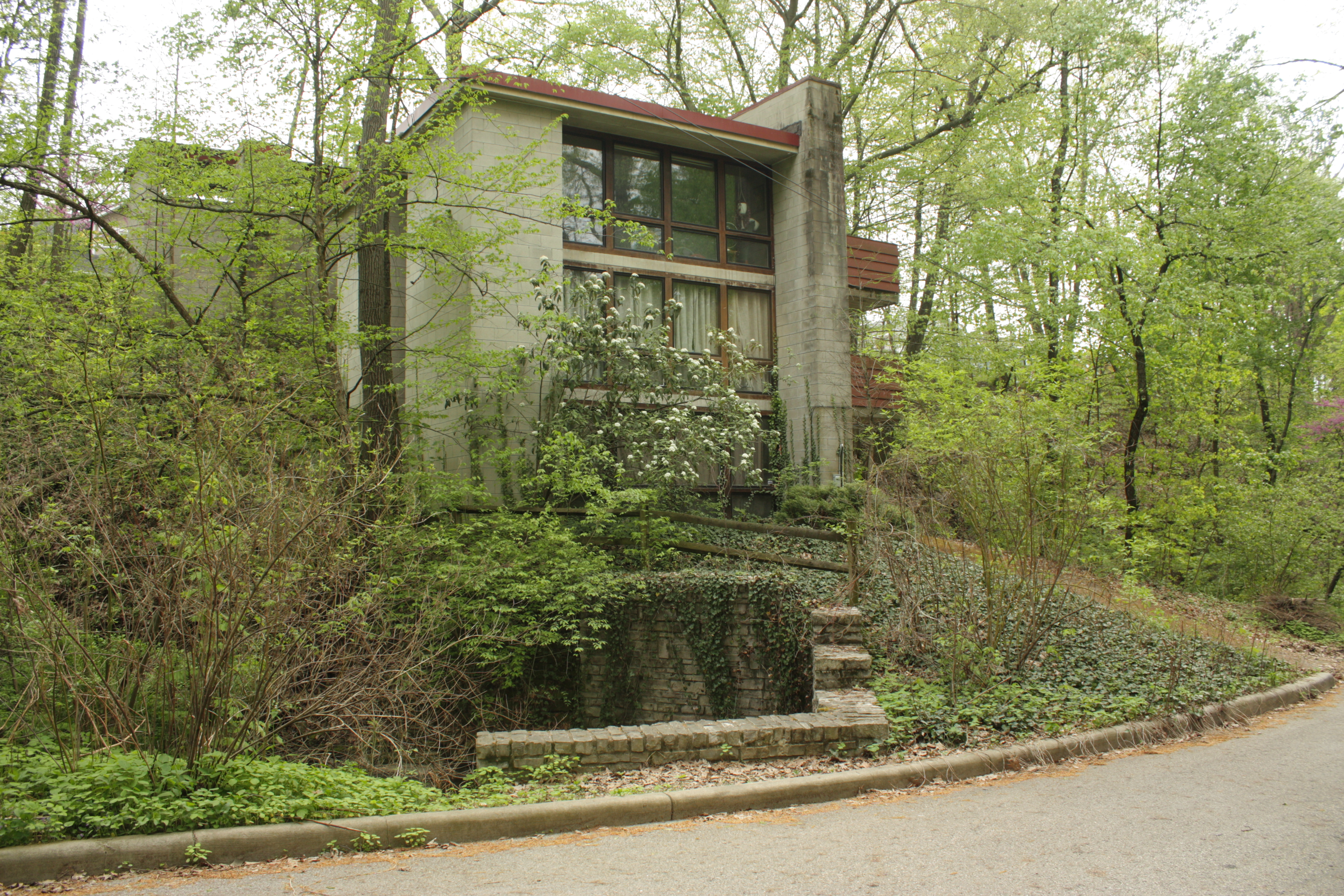
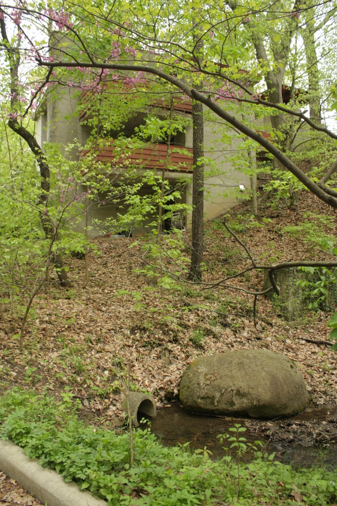
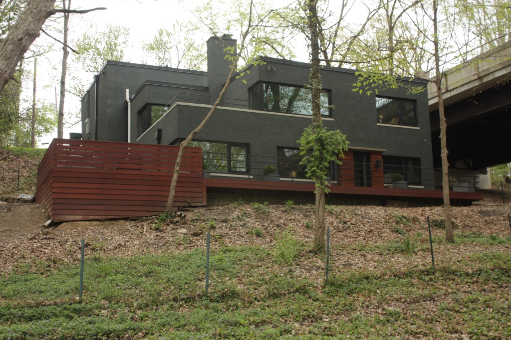
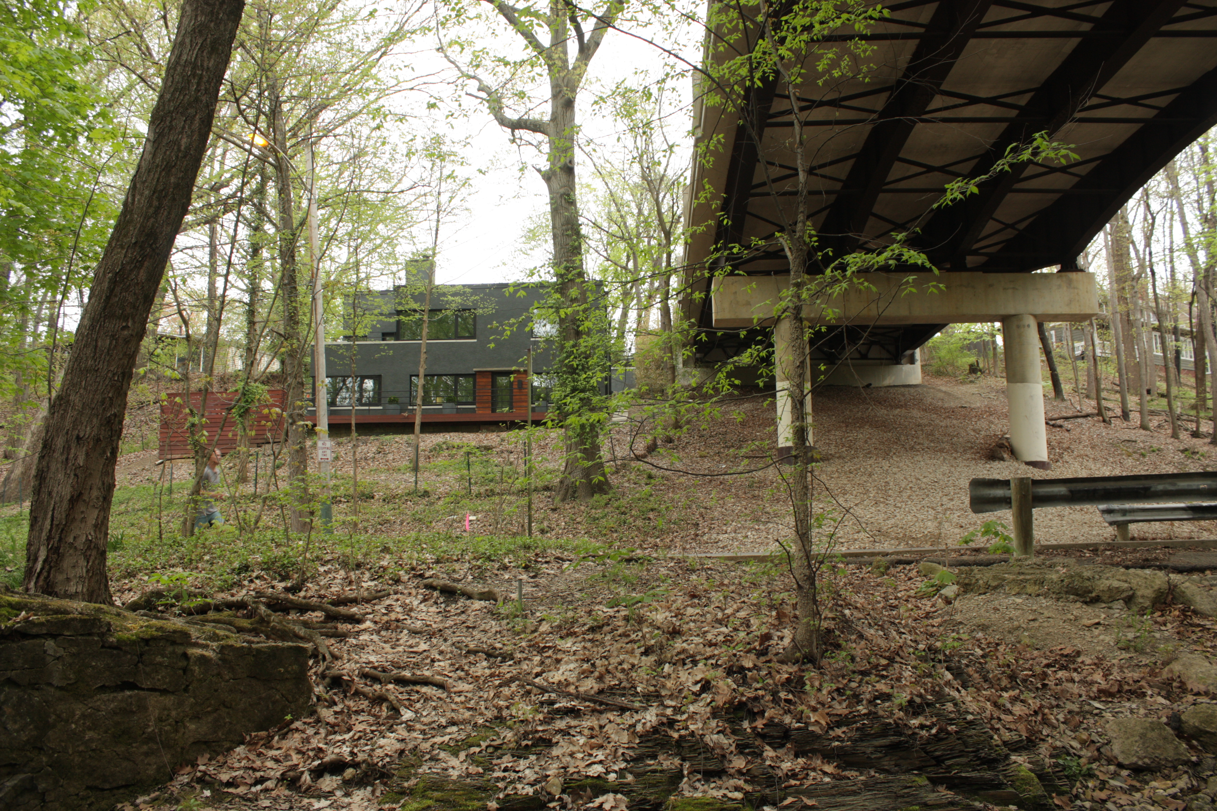
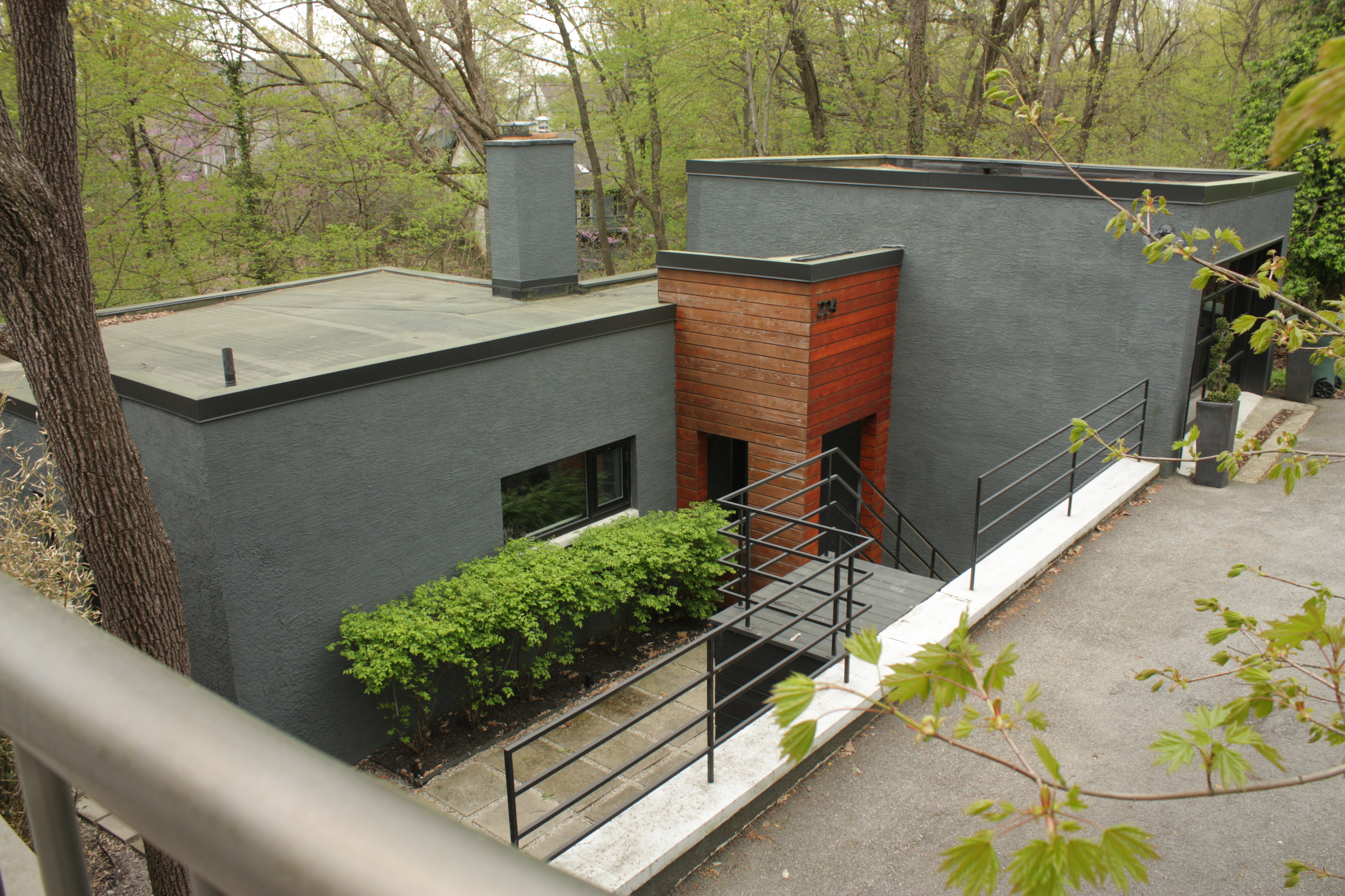
Any stream would be happy to lie down and babble here! “La la la, I’m a happy little brook…” Continuing east, the lone bench in the whole ravine is mounted atop a culvert. (Only one? Residents, demand more!) But what looks like a simple undergrounding of the stream is a little more complex here at another pinch point. Let’s skip ahead to the house barely visible in the upper right, at the flowering redbud tree: This is a nice little 1965 International styled house sitting on the south side of the ravine, a bit like Wright’s Fallingwater. (And that’s a compliment from me, a wild Postmodernist at heart – read my snarkiness on the stale styling of Olentangy Village and worse.)
Something that would blend in better might be preferred by some – but the contrast of simple and plain but elegant concrete block and maroon wood trim creates a dynamism with the natural setting.
And I must say it’s better than those three blander ‘Builder Modern’ houses at the west end that try too hard (or are too cheap and thoughtless), and end up breaking the rules the wrong way – e.g. oculus windows and projecting elements of the wrong size at the wrong location.
…And like Fallingwater, it partly sits atop its hydraulic setting:Down within the stone courtyard in front of it is an odd bit of plumbing, which looks like it took a bit of calculating. The chamfered low rectangular culvert on the right feeds the creek under the road for a few hundred feet, to its end under the bench.
But that’s apparently only for times of heavy flow. The light flow of ordinary times never drops down off the shelf into the culvert – instead trickling into a much smaller semicircular culvert to the side (top left) that runs under the entry to the house……and then apparently out this little pipe by an erratic boulder, forming a slow pool west of the house…where it presumably overflows somewhere into the main culvert.
(If I were the owner, I would disguise that crass concrete culvert, and enhance the pool with wetland wildflowers and amphibian-friendly aquatics.) But while the trickle flows under the gravel walkway or driveway, the big culvert is probably marked by this manhole cover over it in the centerline of the street.
Looking east, another manhole is farther along. Both probably access the sewer line, one ahead of the culvert and one atop, in case something goes wrong down there.
(Oh, and thanks for keeping the walkway or driveway halfway naturalistic with gravel – instead of a white sheet of concrete or black hole of asphalt!) Farther west, another manhole cover is conveniently labeled. The blue paint but “dry” designation imply it is access to stormwater drainage, not sewer – and is probably fed into by this drain grate on the south edge of the road.
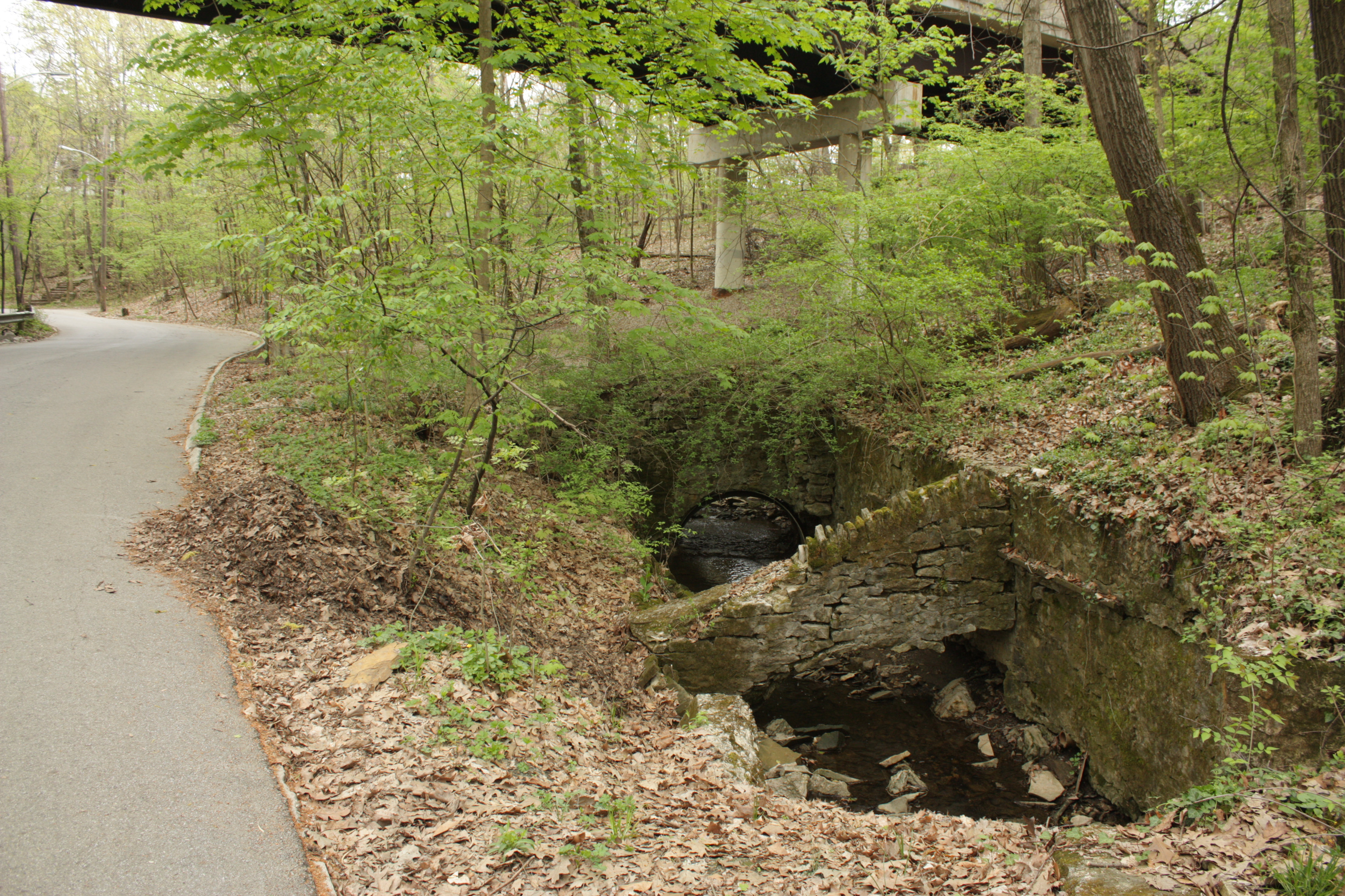
Either way, the two flows from the house weave westward……which then join together somewhere and babble out this cave-like tunnel with a cool outdraft. Back to the hillside house: Its garage is at the top of the slope, on Weber Road. A walkway bridges that to its third floor above Walhalla. Like many houses here, its address is probably a split personality.
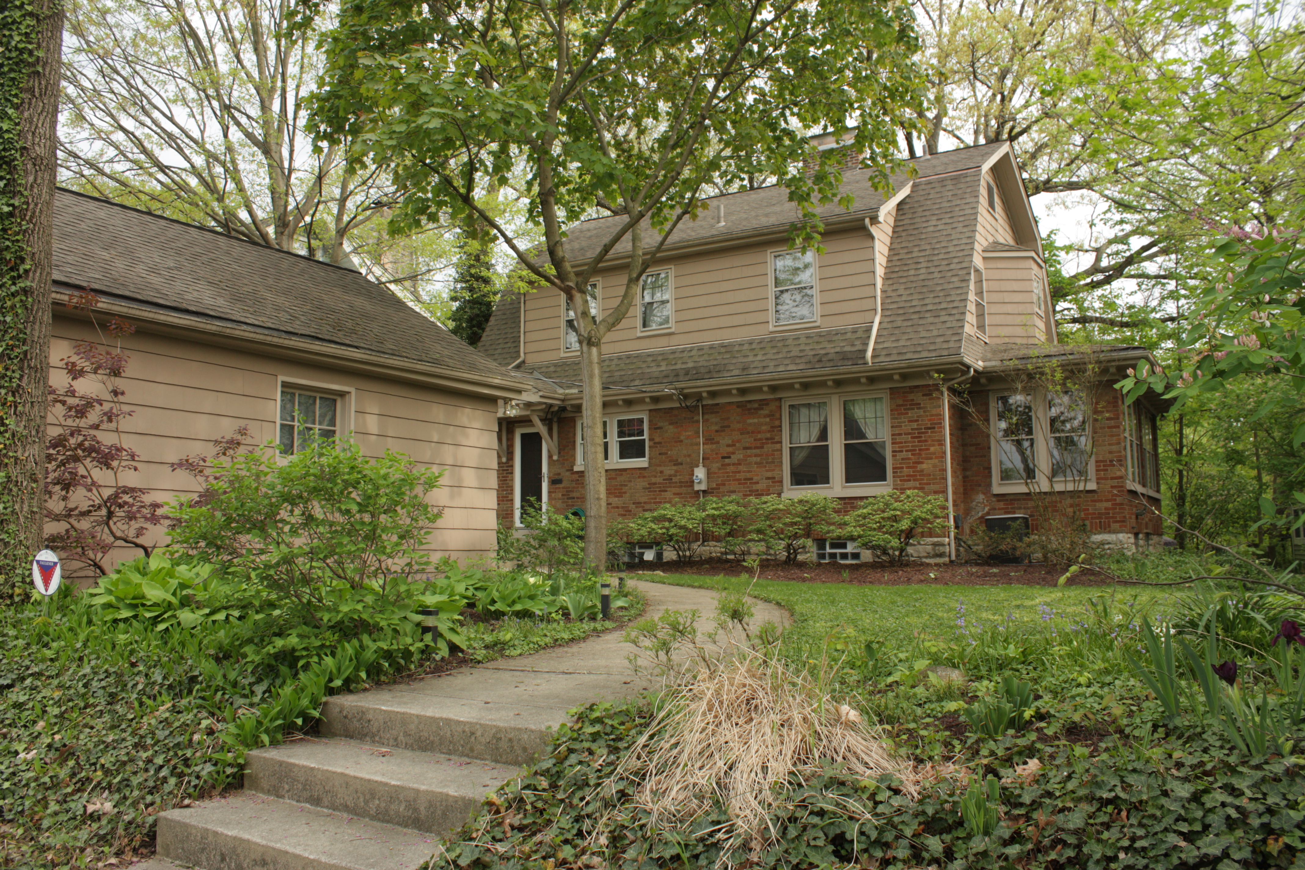
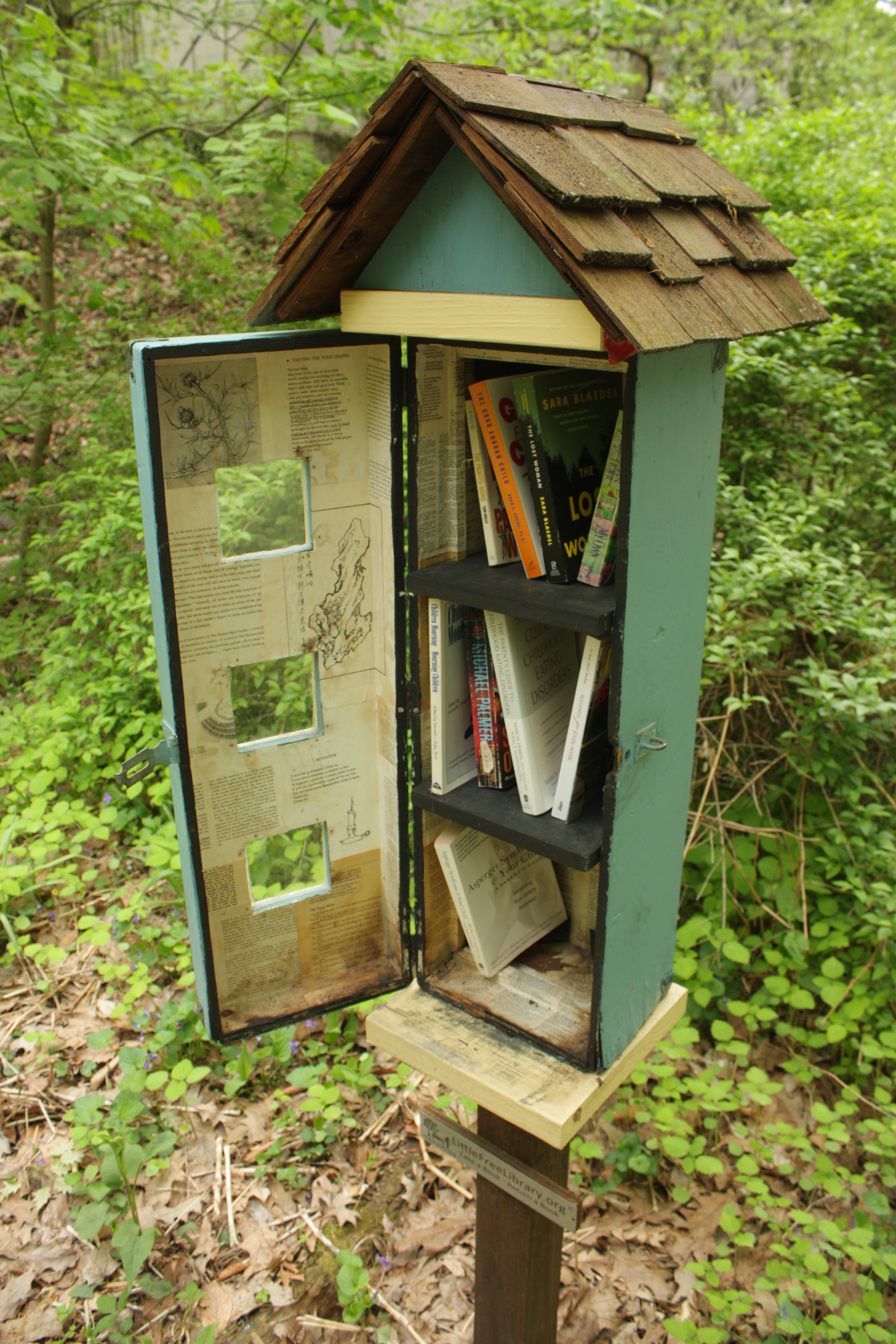
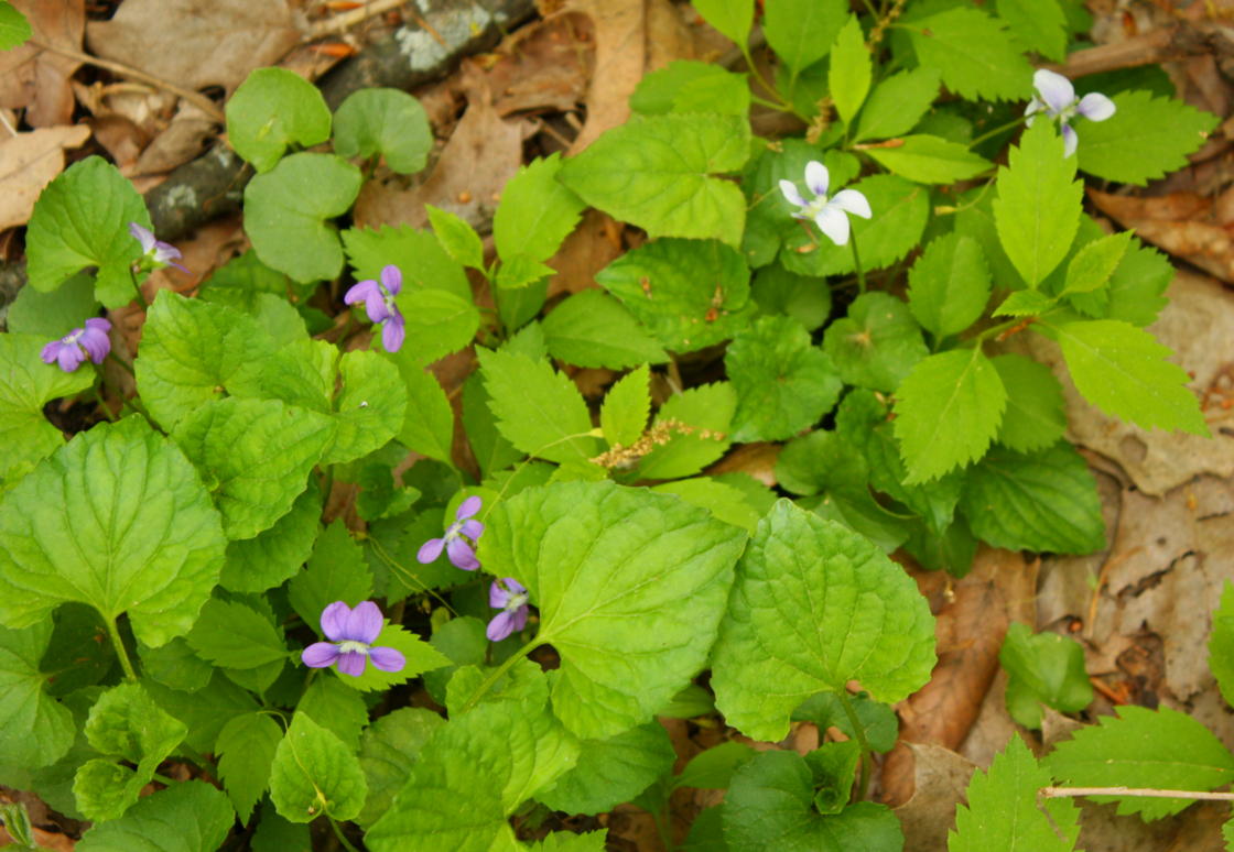
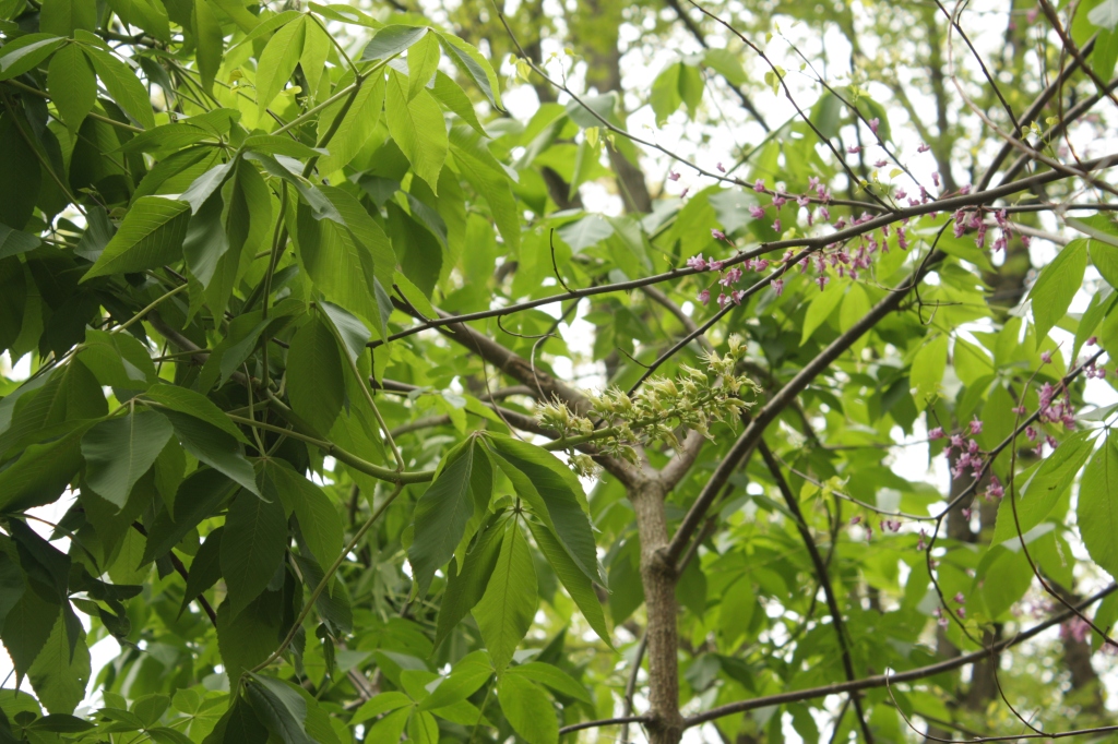
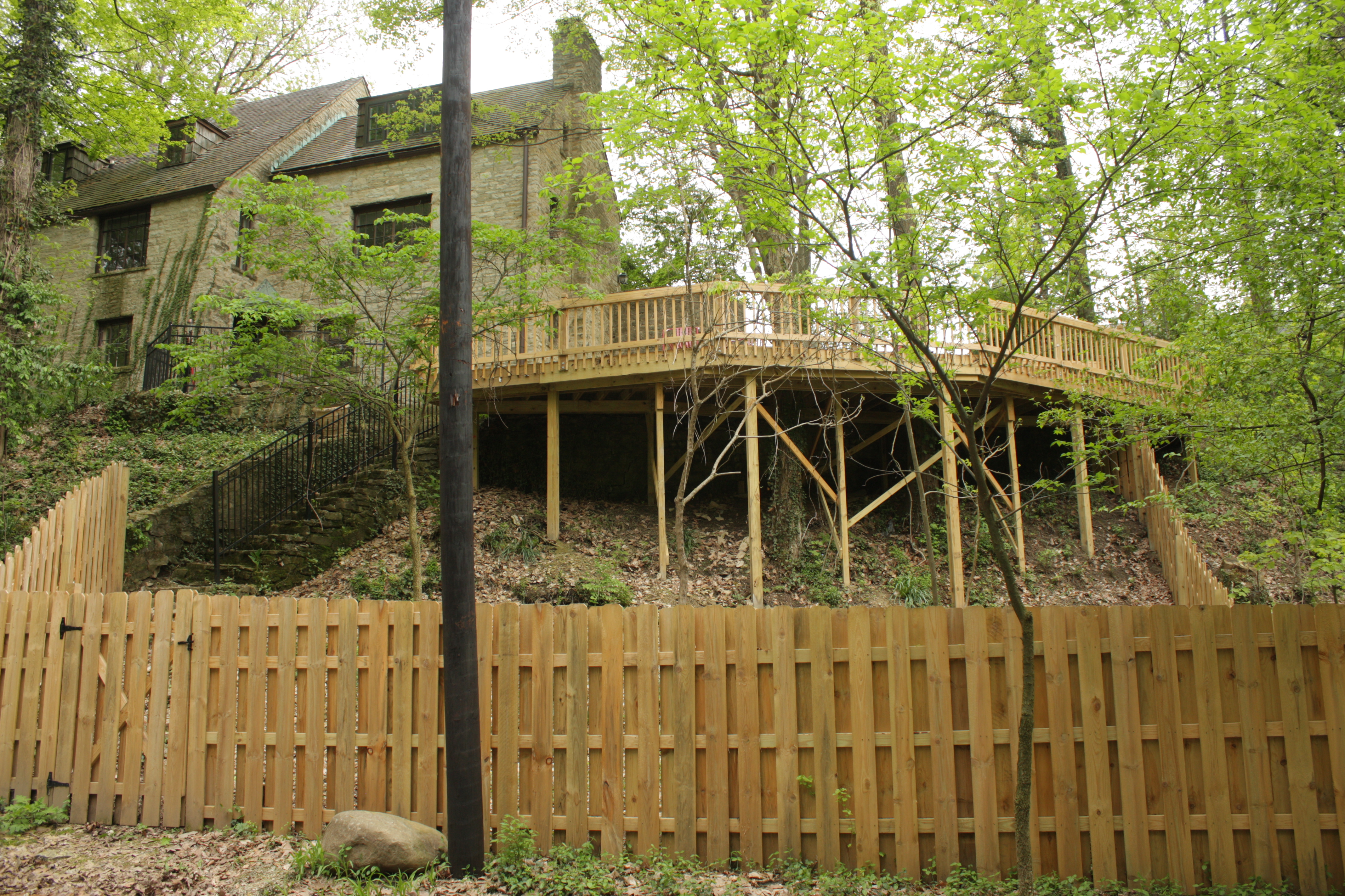
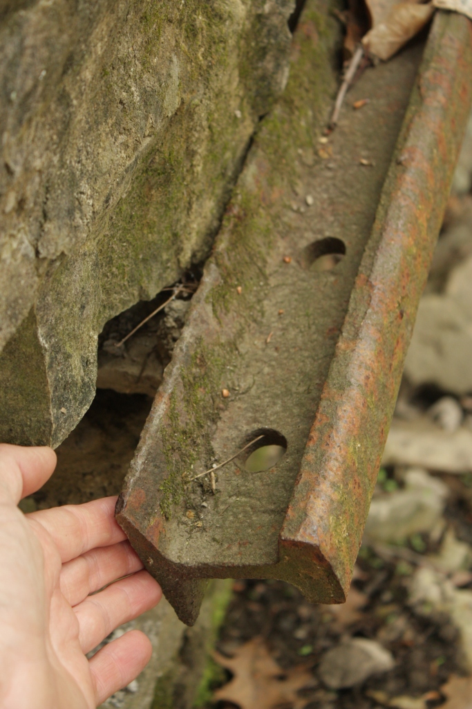
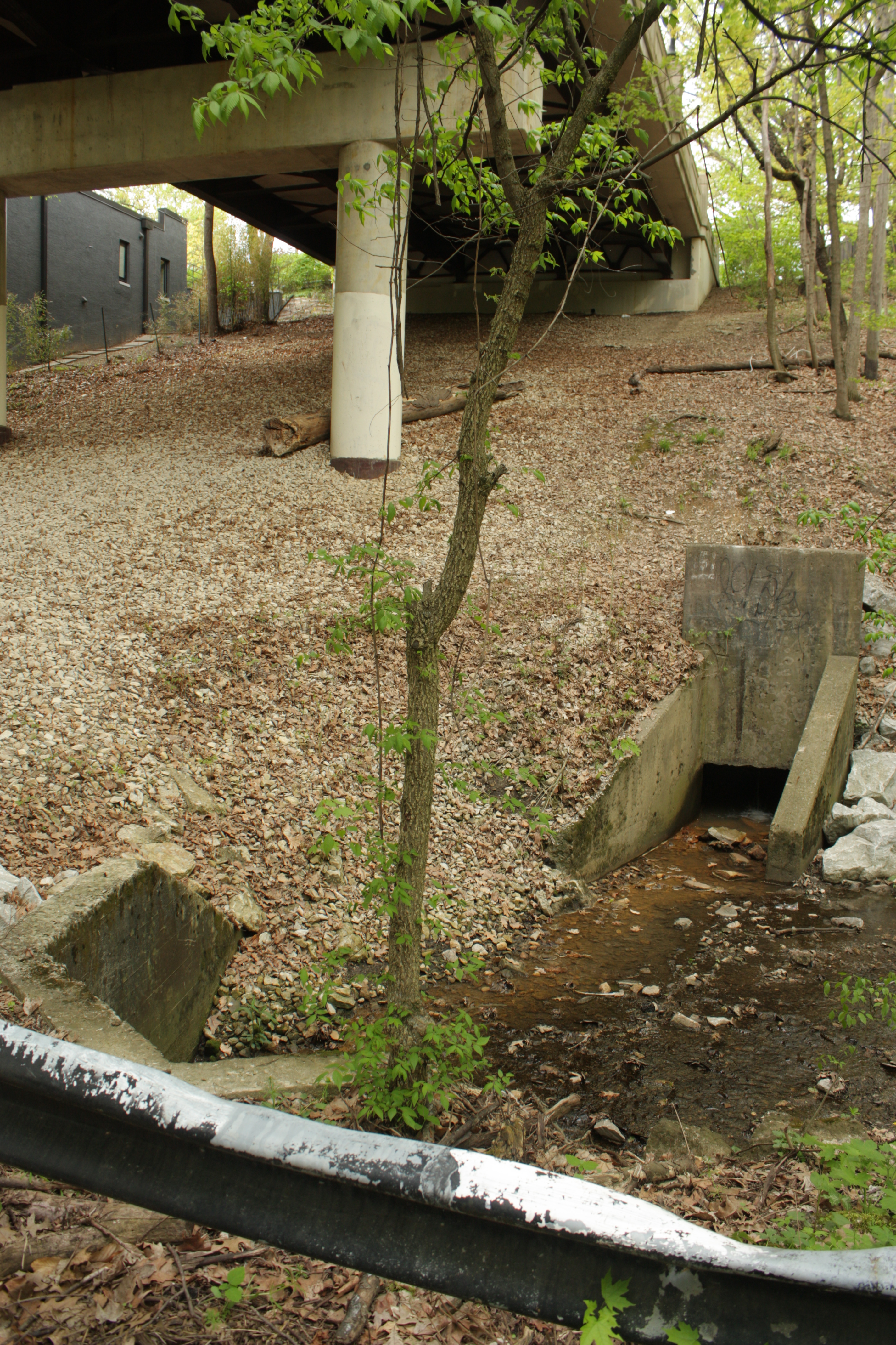
Below the slope is some exposed shale bedrock at the stream, and a few ferns……part of a charming little wildflower bed that features one of those little loaner libraries. They’re a cute idea, and usually take after the house whose yard they are sited in…but not here. Two species of native violets frolic here…and everywhere else. Good thing they’re edible and medicinal – otherwise they’d just be excessively pretty and overly abundant. Two small understory trees flower over the garden: the state tree Buckeye on the left (working on conceiving mildly poisonous nuts), and the freaky legume Redbud on the right (its pea-like flowers and young seed pods are edible). Next up, this 1934 limestone Tudor has a new stilted deck and fencing that desperately needs to weather grey. Again, this one has a split identity between above and below. Across the way, a 1925 semi-bungalow perches on the north rim, a member of the first generation of residences in the Walhalla Park Place plat. The same house, with its garage, backs up to California Avenue. The original clay tile roofing is an uncommon survivor. Another modernistic looks like it was shoehorned next to the Calumet bridgeI hope the bridge is a good neighbor. Well…I know it it isn’t quite, after seeing a pizza box tossed onto the roof.A view from the bridge. This 1940/2007 house will be for sale soon, too! (You might want to add curtains or blinds.)Across the road is what appears to be a survivor of the original development of the ravine: a disused driveway culvert and two flying buttresses (one out of sight) reinforcing a retaining wall along the stream, all built of local limestone except……horizontal reinforcing of the wall by a long section of railroad rail. Judging by its smaller size, I’d say this was scrapped trolley tracks – possibly horsecar tracks made inadequate by electrification about c1890, and still lying around when the ravine was developed sometime between 1900 and 1910. And catty-corner on the other side of the overpass is a unusual outlet from storm drains above, just upstream from the culvert under the road under the bridge.
(I know, “We want more bungalows and violets! Deer and owlets! Lose the concrete caves!” Sorry, I can’t help highlighting my irrational fears and aesthetic critiques.)
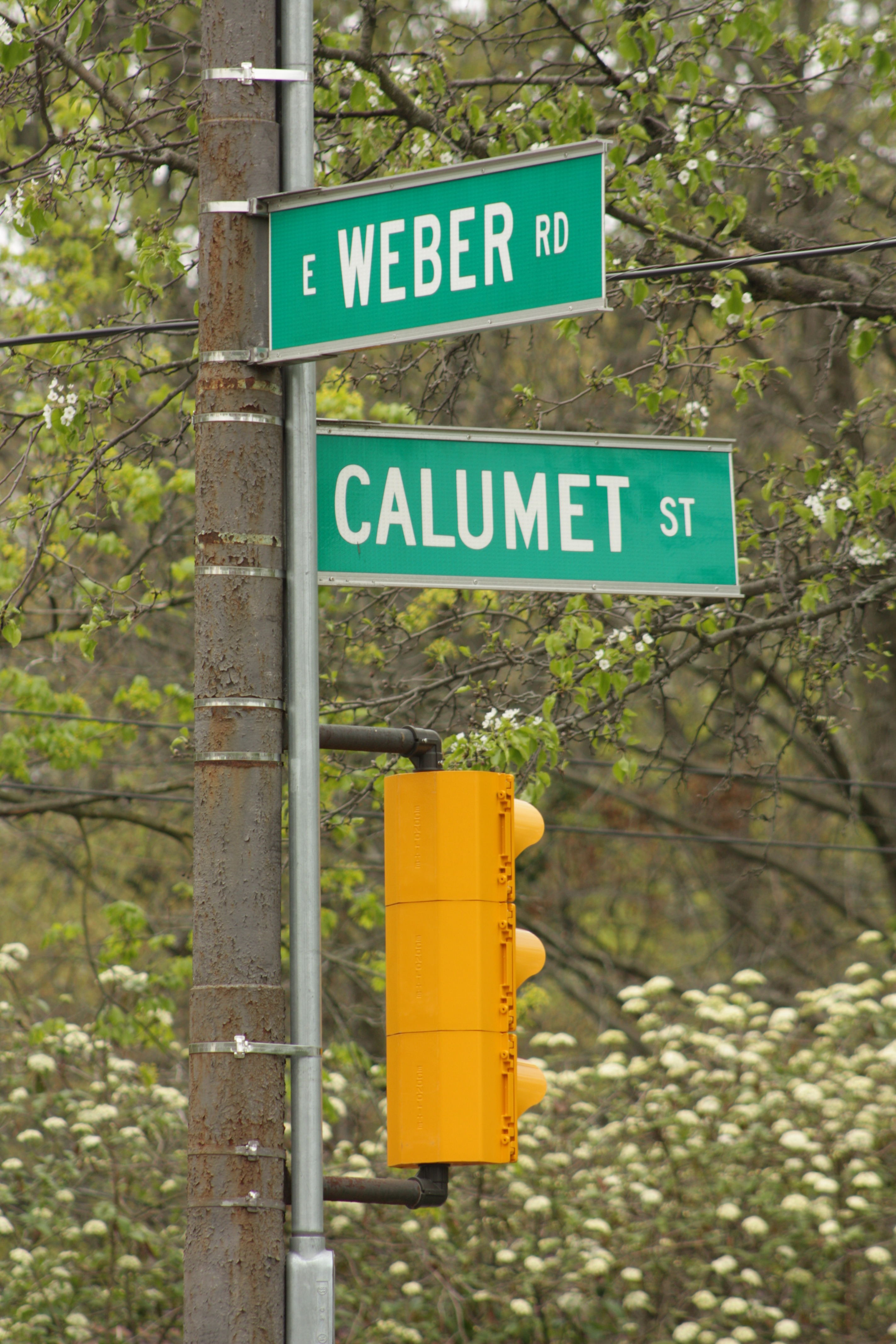
Speaking of this bridge:
…it’s for Calumet Street…
…which crosses Weber Road…
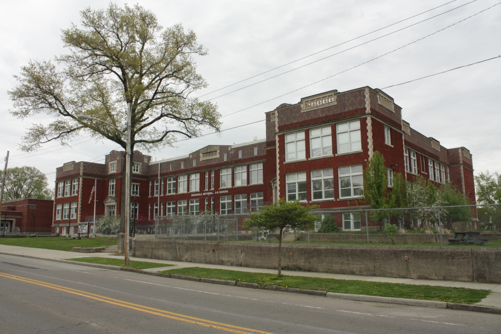
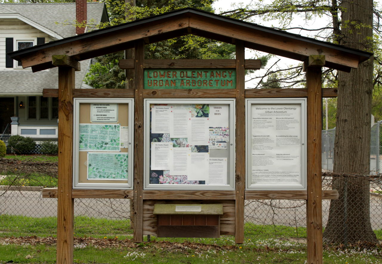
…at 1914 Crestview School / Indianola Informal K-8…
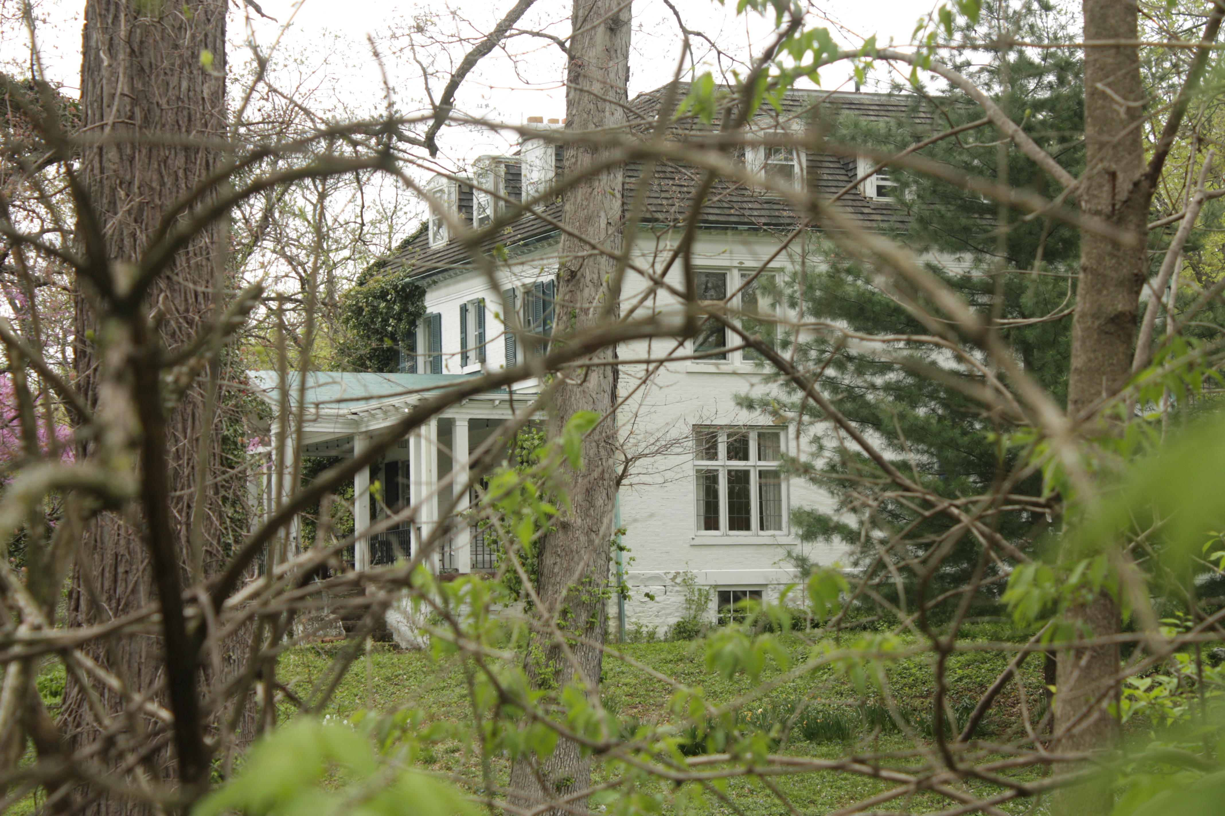
…catty-corner from the “Lower Olentangy Urban Arboretum“…where I parked and started two of my visits to the ravine. But…what do we have here, in the ravine just up from the bridge and beside the arboretum? And who’s head may have bounced down the hillside near this? Whose murderer may have hanged himself from Calumet bridge?… …Supposedly because of an argument in this isolated house, atop forked tributaries?
More soon in part 3! (Hopefully before halloween. ; )
Thanks – and these are just the ones easiest to comment on from the best of the best (but that’s how editing works). The bookboxes are quite common, especially in Columbus, but I don’t know much about them.


Great photogallery:). Love idea of bookhouses:). Gr Stef
LikeLike
Thanks – and these are just the ones easiest to comment on from the best of the best (but that’s how editing works). The bookboxes are quite common, especially in Columbus, but I don’t know much about them.
LikeLiked by 1 person