
Post Number 11 in a Continuing Series (on Facebook)
I continue with what I’m calling the “Piketon Graded Way Earthworks,” an Adena / Hopewell complex in Pike County, Ohio – which comprise two earthen ramps on either end of a relatively short natural earthen terrace, some earthen walls, and a mound cluster – variously lost, unknown, ignored, or unconnected. Thanks to the work of others, I think I’ve pieced it all together…
…IF what has been pointed out to me is correct, and all my assumptions and reconstructions from old measurements – which appear to internally self-verify! – are accurate.
I’m also now calling it the “Piketon Graded Pathway,” since the graded ways are only two parts of it, and most of it is a strongly implied path shepherded mainly by one earthen wall (and with two mound clusters on either side of it).
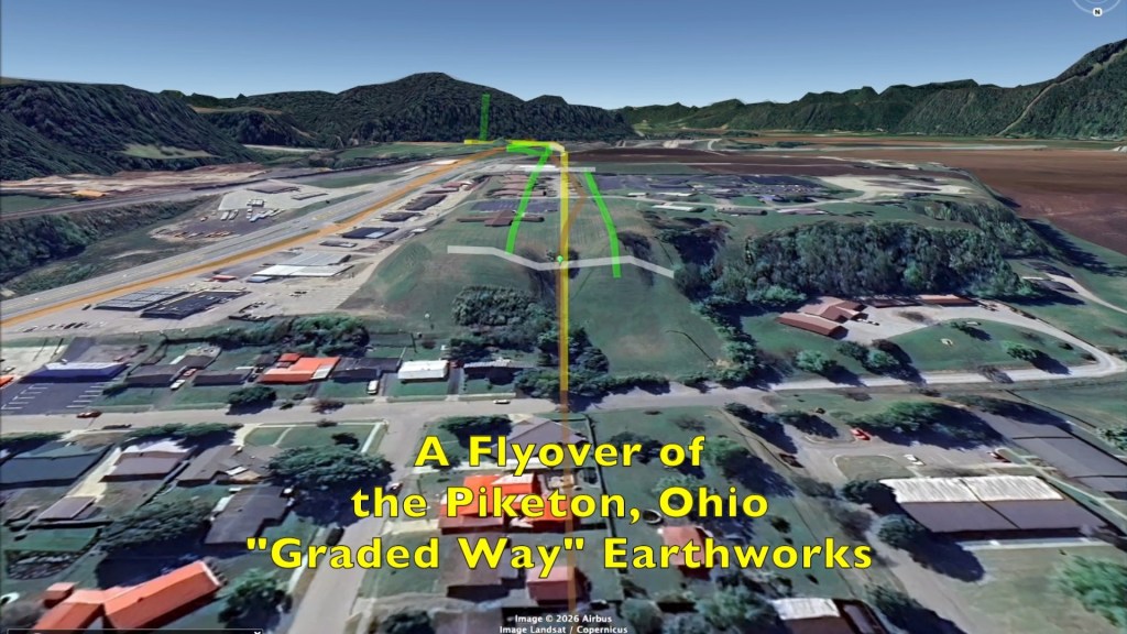
See my previous Facebook posts* for an explanation of this prehistoric modified landscape…the three versions of US 23 involved with it…and reconstructions of the complex in Google Earth Pro – as well as my two videos of Mound Cemetery from Tuesday.
Follow the below snapshots from my field trip on May 9th for my narrative. (I also added an overview map at the end here.)
(Be sure to respect privacy and private property! And invasive state law says you’re not supposed to operate a digital device on a public road…unless you’ve stopped or pulled over.)
* Previous post, on Facebook: Piketon Graded Way Earthworks post number 10
The popular idea is that the Piketon Graded Way was destroyed when the 1950s ‘version 3’ of US 23 was built through it, just south of Piketon. (See my Facebook posts number 7 and number 8.)
This is a current view of that, looking north from ‘version 2’ of the road – now a private lane beside the former “Ohio Candle Company & Gift Shop” that dead-ends at the railroad.

But behind the commercial development on the east side of the freeway, left of center here, ran version 1 where the real Graded Way hides almost in plain sight – mostly folded into itself, but with great potential as a recoverable archaeological preserve that would add context to our local World Heritage parks.
This unique Adena / Hopewell earthwork complex deserves recognition for surviving and for being relatively unique. These Ancients built a few “graded ways” – earthen ramps cut into bluffs between natural terraces – but this is probably the grandest, and possibly best overall ‘preserved,’ example.
At the southern edge of the suburban expansion of Piketon is a row of ranch houses on nondescript Thornton Road.
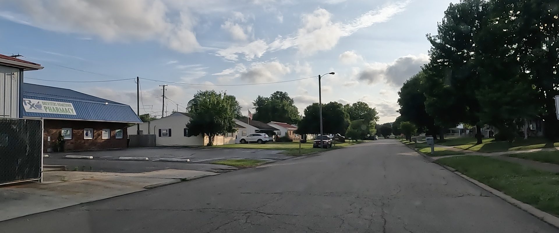
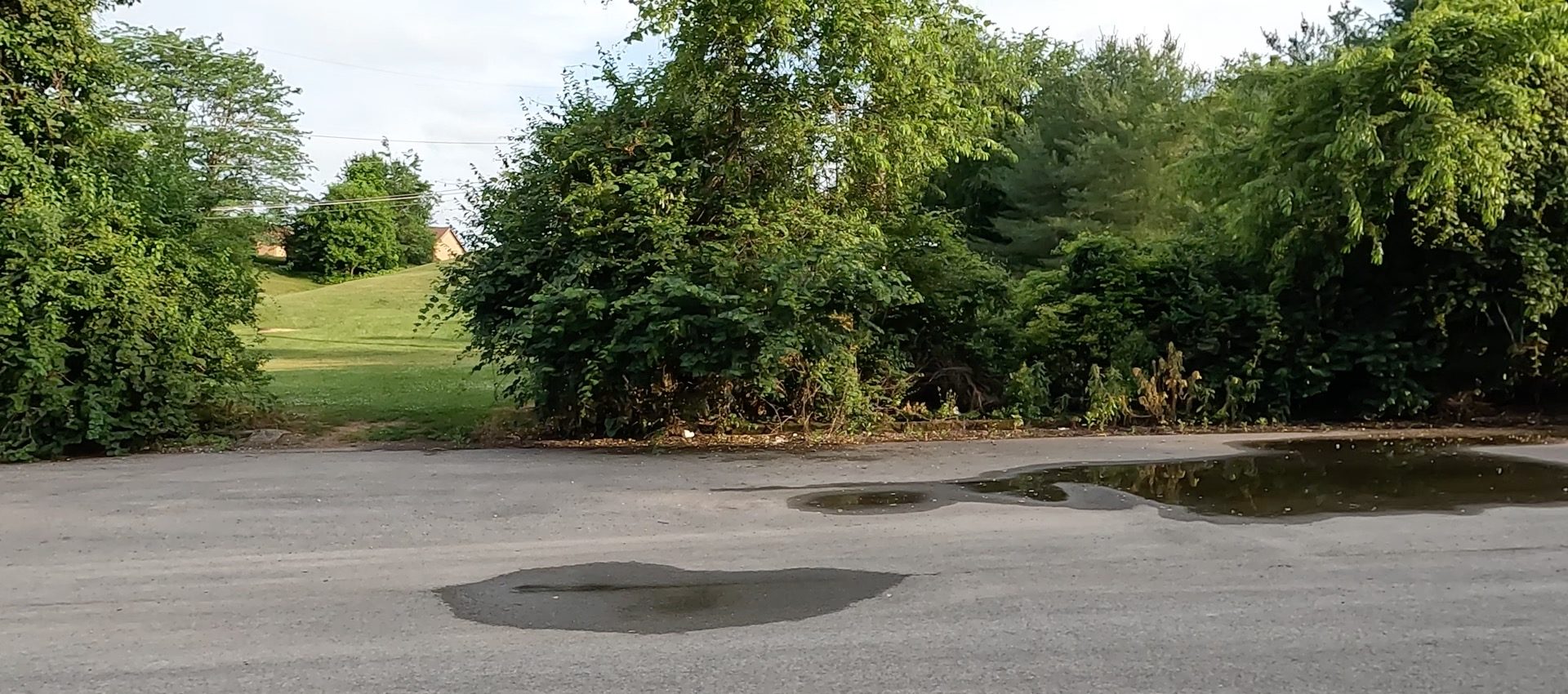
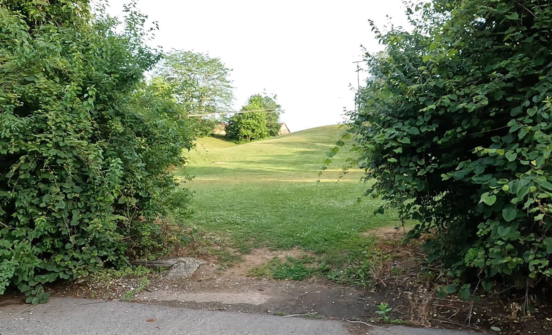
At the end of that street, and the start of Paradise Drive(?), is a wide intersection. Peeking south through a gap in the vegetation, we can see a couple of curiously vacant lots, with a bluff rising behind them…
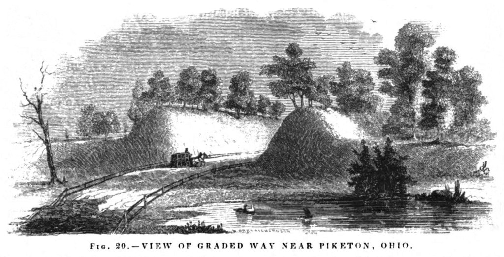
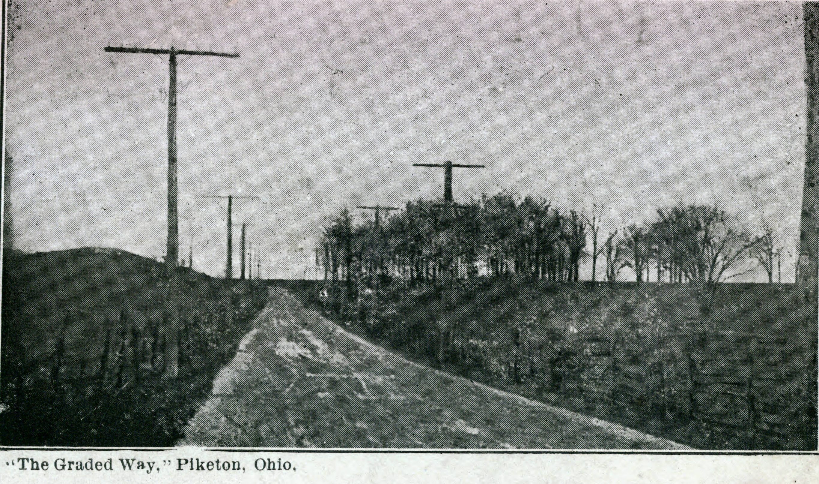
…This is the remnant of the Piketon Graded Way – specifically, the northern Graded Way, as dramatically illustrated by Squier & Davis in 1848.
This is where the Ancients cut into the bluff by hand maybe 2,000 years ago, creating a ramp and high side ‘gateway walls’ – with one of the walls extending south for more than 1,000 feet, before angling over to what is now Mound Cemetery…and then on to the southern Graded Way.
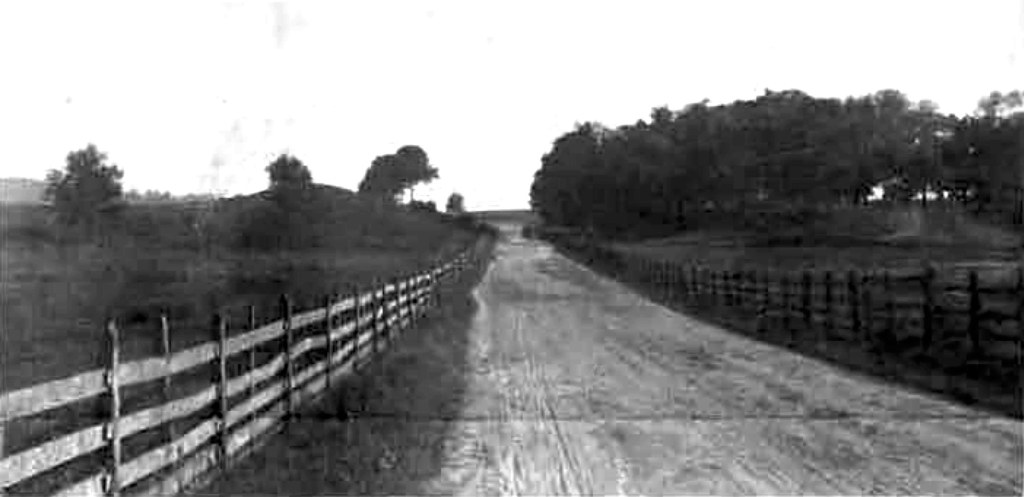
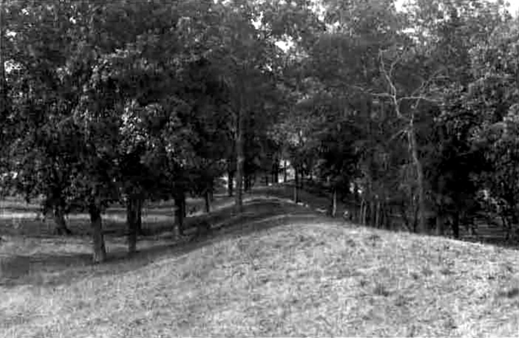
It’s complicated, and you’ll understand better if you read my previous posts and watch my simulated flyover videos. The first version of US 23, a gravel turnpike, used the graded way as an easy route – as you can see in the above historical photos.
But what the experts don’t realize, is that around 1900 the road was shifted onto an entirely new alignment a block to the west as its second version, later also used for US 23 version three in the 1950s. Plus, it looks like the Gateway Walls were eventually bulldozed back into the Graded Way, greatly degrading its drama.
This site is private property, so let’s not go there without permission. (But soon, let’s diplomatically and respectfully try to get this preserved as a park! Who wants to find funds and a helpful nonprofit, and be a prehistoric diplomat?)
See my Google Earth Pro renderings of the site for a better and noninvasive overview. (Click on the above screenshots from my videos.)
There is a residential street that crosses the Graded Path/Way back of this bluff, so let’s go there. Its name shows that someone knew something was here…even though they built on top of parts of it.
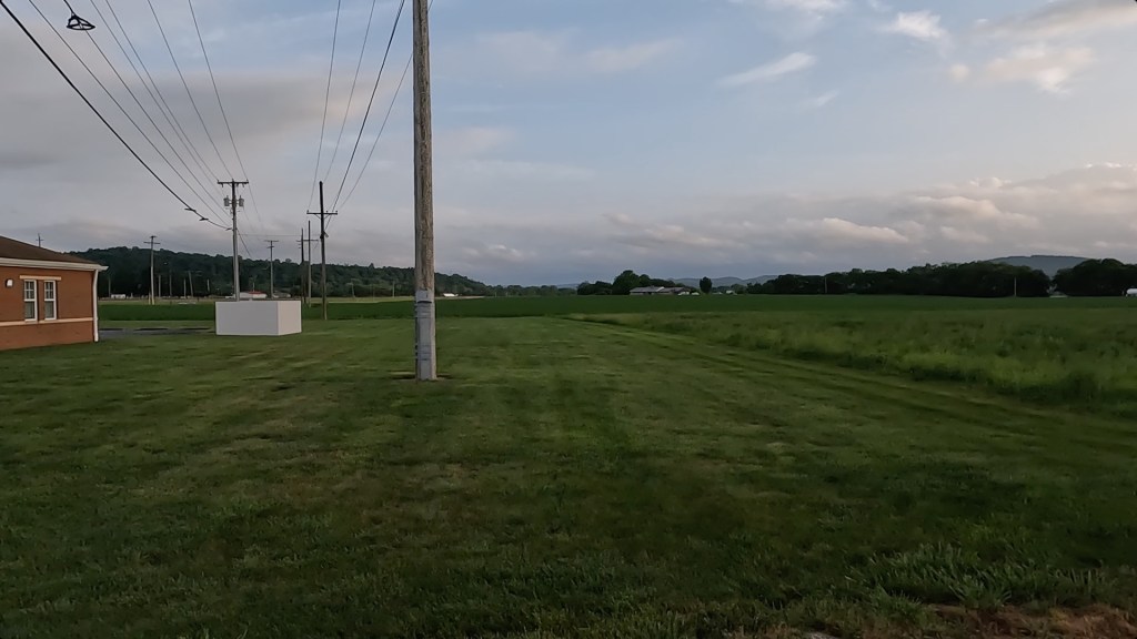
Atop Indian Ridge Drive, on the north side, is a medical building. It is probably on top of the flattened east Gateway Wall – which probably heads straight towards where I took this photo:
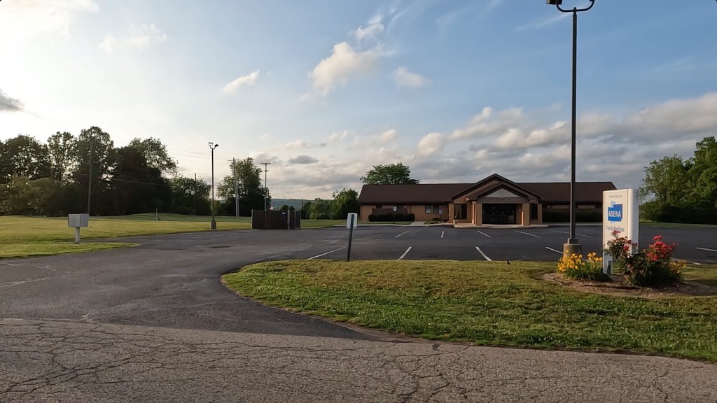
The centerline of the Graded Path/Way and of the Turnpike (the first version of US 23) ran along this side of the power line to the left.
Maybe Adena Health System would be willing to cooperate with preserving their remnants of Adena / Hopewell earthworks!
Below, again looking south from Indian Ridge Drive, now between the power lines on the west side of the north Graded Path/Way and Turnpike: The Turnpike and the centerline of the Pathway ran just on the right side of the right power line.
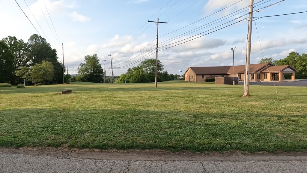
Again, the medical building on the right is probably on top of the flattened east Gateway Wall.
A probable remnant of the west Gateway Wall is the lump in the left distance, way back behind the stump between the power lines. (You can also see it in the previous photo.)
Looking the opposite way, south from Indian Ridge Drive, in line with the Turnpike: The powerline with a pole right in front of me is running along that, and the parking strip is probably on the east side of the Turnpike.
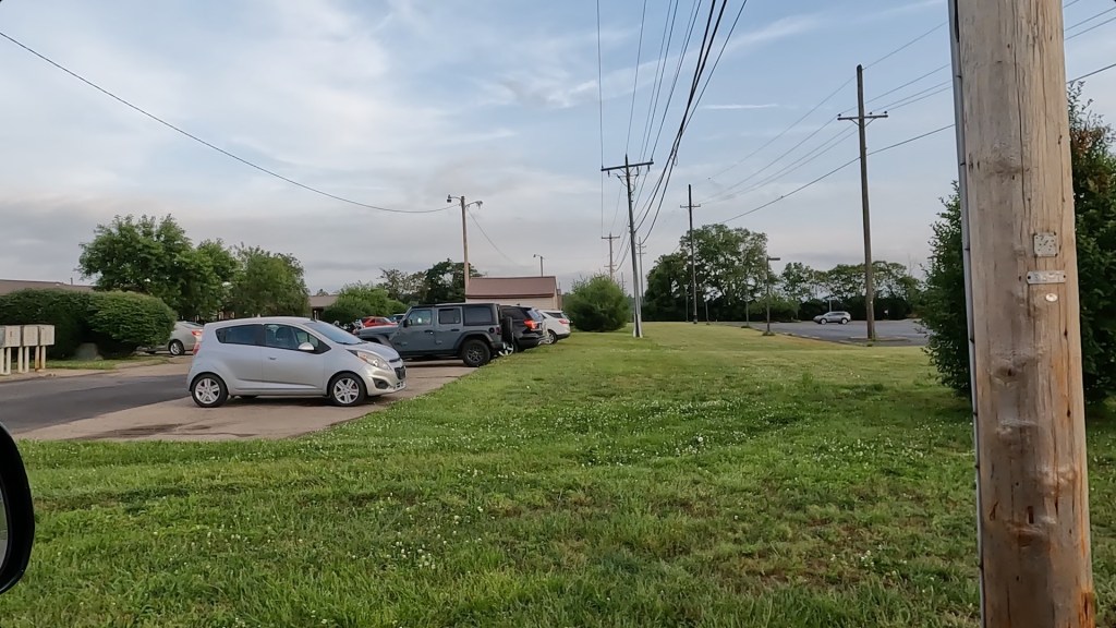
At this point, I think the turnpike is slowly angling to the left (east) within the path of the graded way. (Again, see my mapping for clarity.)
The centerline of the Pathway may be behind the gray car, at the darker asphalt on the left.
The western Gateway Wall had continued all this distance, and may have been in the greenspace between the near power line and the far asphalt parking lot on the right – fortunately not built upon. It ended a little past the far treeline (which may help preserve a sample of it).
The implication by Squier’s 1847 survey of the Graded Pathway is that the earthen slope cut by the Adena / Hopewell extended as far as the Gateway Walls, more than 600 feet – again, past that treeline.
And while I’m on the topic, most of the maps in “Ancient Monuments” were not surveyed by Squier, but copied from others’ surveys. This is one of the few that Squire himself surveyed – my guess, because others had not surveyed it yet.
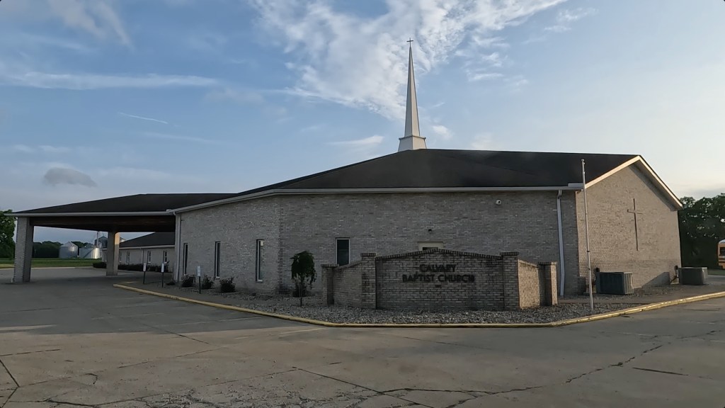
Ok…two of the most fantastic earthworks by the Adena / Hopewell are octagonal…and here at the end of Indian Ridge Drive is a church next to one of their more obscure earthworks, a building which is…octagonal.
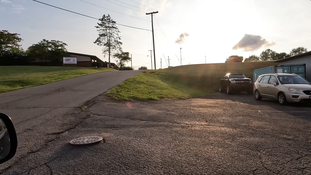
And looking east on Indian Ridge Drive from the top of the terrace, down onto the commercial development along US 23:
A little farther south is a driveway to a farmstead. Commercial lots along US 23 have been sold off from the farm and developed, so I drove up the private drive only to the back end of those lots.
Looking north, up the twin powerlines, at the back end of the buildings facing South West Street and US 23:
The old turnpike is on the right (east) side of the right powerline. It is crossing the centerline of the Graded Pathway again, which is angled slightly to the left (west)…and I may be on top of the Pathway here.
While the west Gateway Wall of the Graded Way ended just this side of the far tree line, the east wall continued…but is now under the buildings.
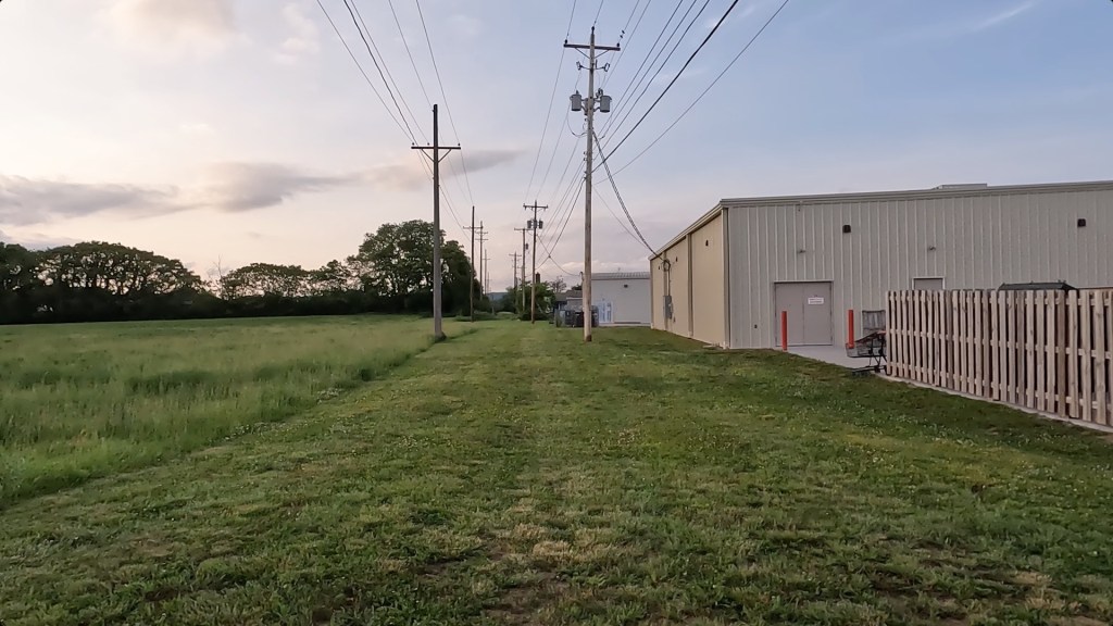
Looking south from the same point:
The turnpike continues with the powerlines, while the centerline of the Graded Pathway continues approximately straight ahead. Its guiding earthen east wall may pass under the brick building.
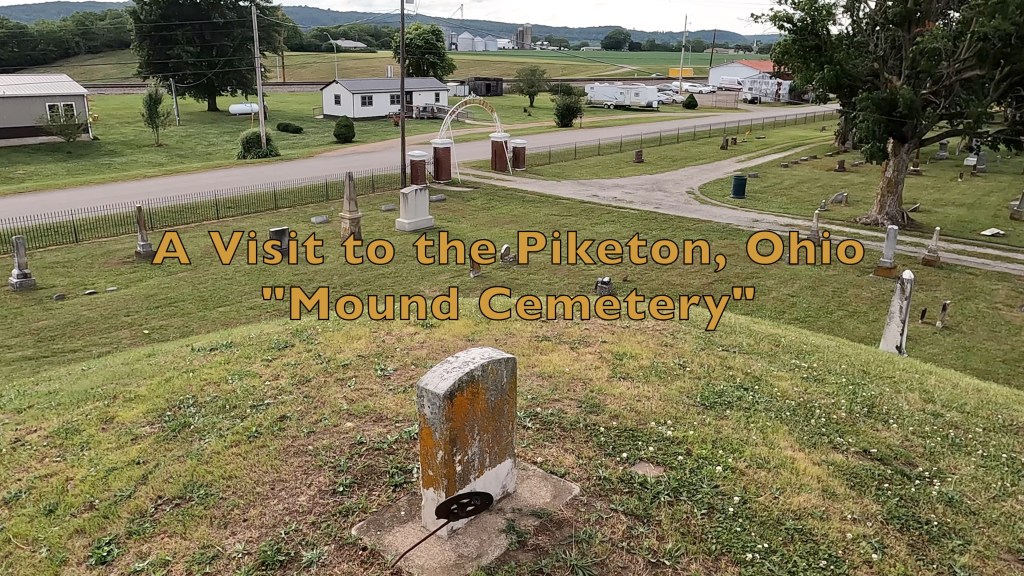
Then, both the Pathway and its guiding earthen wall angle over to the left (east), and head towards Mound Cemetery and the white building in the distance, visible just above the dumpster fence.
The path of the Graded Way could have continued straight, dropping off this terrace and continuing on the path of old US 23 in front of the hills to the left that the former Gaseous Diffusion plant hides behind – most certainly a ‘natural’ trail / major footpath. But instead, the Adena / Hopewell people artificially re-guided this natural path in a slightly different direction so that it heads into those hills.
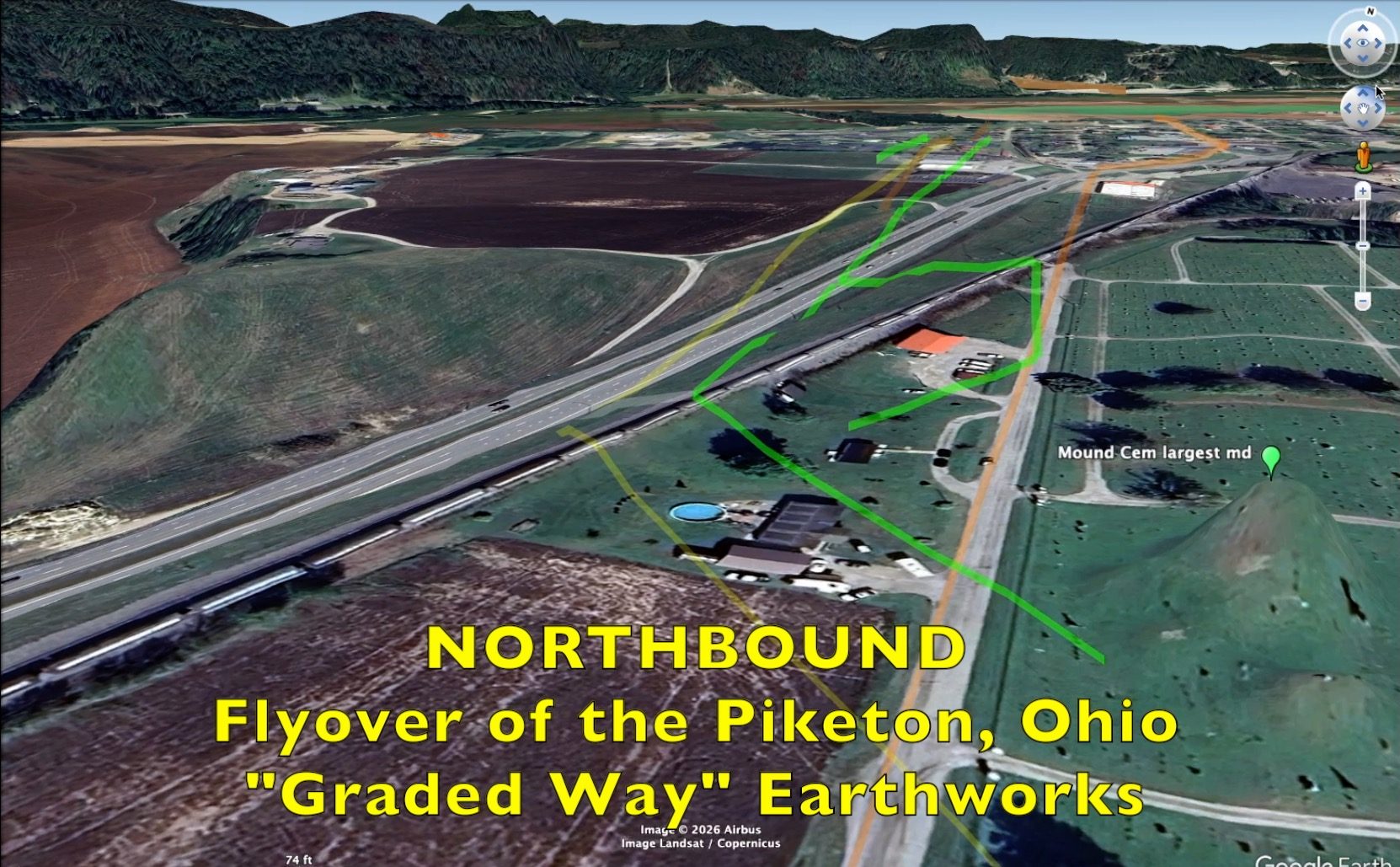
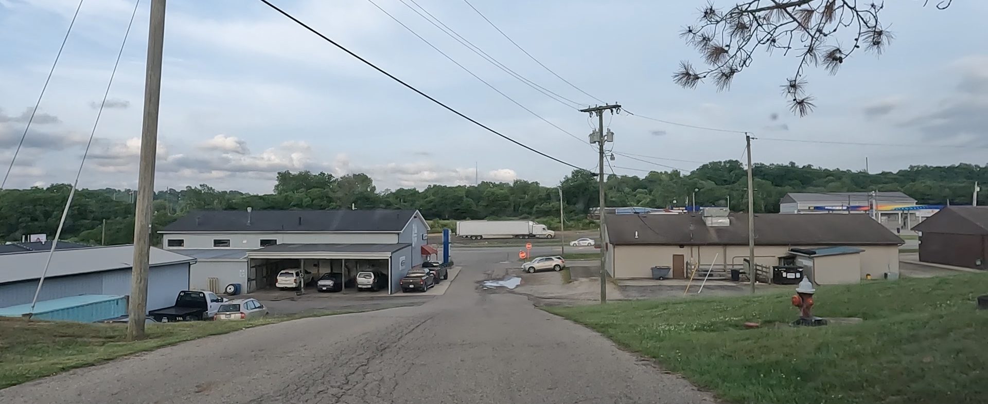
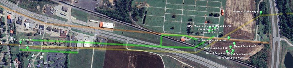
The faded roadway of the turnpike is clearly visible in aerial photography a little beyond this point, at a field access road off US 23 – look for it in my Google Earth Pro flyover videos, and below.

You can clearly see the faint renmant Turnpike roadway (version 1) continuing through the powerlines, then being obliterated at the excavation for freeway US 23 at “Corridor C.”
Version 2 of US 23 is the road angling from the orange roof down to “Send” at the railroad. Version three is the divided freeway in the middle.
Past that point, excavation for the freeway has destroyed the Turnpike remnant…as well as the Graded Pathway and its earthen walls. But, they are largely undisturbed – other than being plowed down – past the railroad.
Again, that Turnpike was the first version of US 23. The realigned version 2 runs past the former Candle Company, formerly crossed the railroad, then continues straight south – now as Mound Cemetery Road.
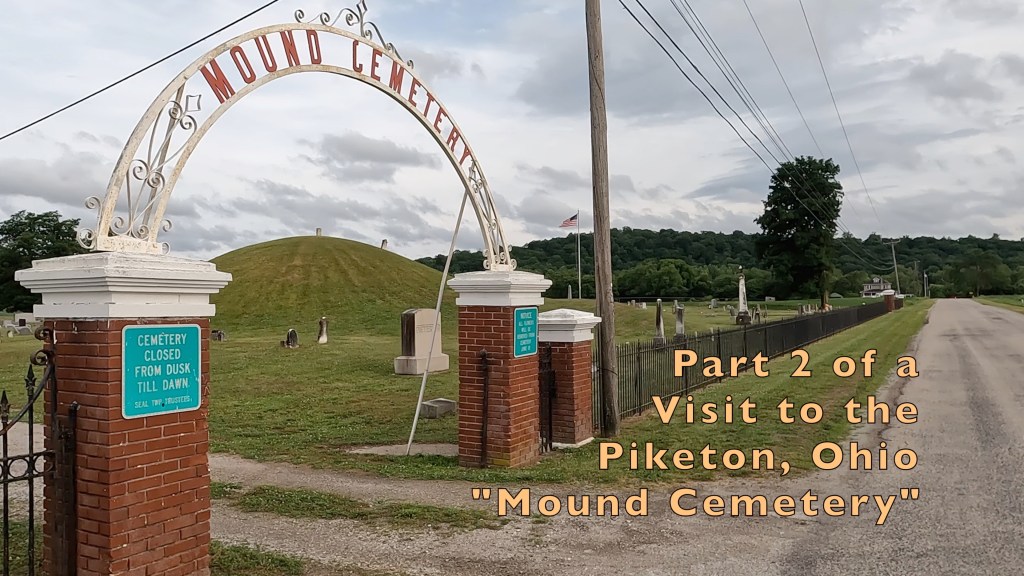
Watch my two YouTube videos of the mounds in Mound Cemetery by clicking the images below:
– not quite the end…the Path continues –
