
“Canal fever” continues for me…or at least, canal obsessiveness.
I should be focusing on getting medæval for my role as an Irish scribe from 1,000 years ago at the Dublin Irish Festival in two weeks – but my hangover from focusing on Chillicothe’s canal system(s) keeps me mulling over new photos and information I found during our canal event July 12-13 in downtown Chillicothe.
(Yes, I keep learning new aspects of our local pre/history.)
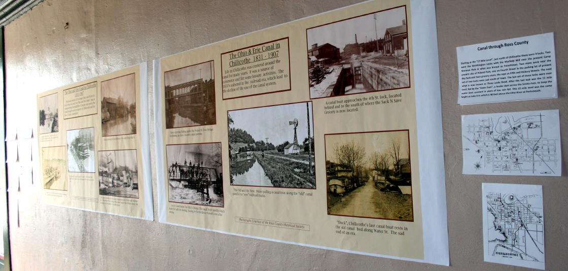
One photo I had never seen before was in one of the two banners we (the Chillicothe Restoration Foundation) hanged in the “Canal Warehouse.” This is the huge brick building at Main & Mulberry built in the 1850s and 1860s, and owned by the so-called “first millionaire of the Scioto Valley,” Waverly’s James Emmitt:

It is a photo from the archives of the Ross County Historical Society, graciously supplied by them for our event.* It is captioned “ducks enjoying the peacefulness of the canal along High St.,” and is a placid scene showing a small barn on the bank of the rippling canal during the growing season.
Domestic waterfowl waddle beside a board fence next to the near end of the building, and overgrown shrubbery cloak the far end of the barn and anything beyond. In the distance, past a slight bend in the canal, is an iron turnbridge over the canal.

This may be the only surviving photo of the namesakes (or near-namesakes) of “Goosetown.”
Goosetown was the working class German neighborhood of Chillicothe, in the north end of the Old West End. There the laborers’ families maintained fowl, as many people did in the 19th century. Waterfowl could maintain themselves along the canal’s waters, including geese…thus, “Goosetown.”
As for the short-lived neighborhood scandal sheet published on a retired newspaper press…and its transfer to a Dixieland Jazz band that plays most Thursdays at the Cross Keys Tavern (an Irish styled pub!)…that’s another story.

Details, Details…
The barn has neat little features that interest an obsessive architectural historian. Head-height square windows indicate the near end of the barn is a stable with two bays for large livestock (horses, mules, or cows), allowing them to look out on the canal. In the gable are three small square openings for flying critters, probably pigeons (to eat) or mosquito-eating birds. A small door is open there to the loft, probably for loading hay.
A small jog in the roofline implies the near end is an approximate 20×16 ft. addition to, or building separate from, the the larger part. That larger part is about 30×20 ft. and has paired windows beside an open entry door, or probably a pass-through, to the shallow bank along the canal. Above that is a square door to the hayloft for loading hay from canal boats, its shutter swung open.
Vertical siding and probably wood shingles cover the building(s). On the near side is a board fence, topped with palings to make it about 8 feet tall – probably protecting a vegetable garden from marauding ducks who might flutter over – which are standing on the bank outside the fence along the canal.
They’re hemmed in by a picket fence or gate that is inline with the near side of the building. The bank shows small pilings and boards holding the canal edge up. Another duck is standing on a sandbar, or mostly submerged rubble, nearby in the canal water.
In the distance, the turnbridge has the characteristic half-height pony truss, and underneath its left side is visible the pier and connection where the bridge would swing. A little shrubbery peeks out near the photographer on the near side canal bank.
Deducting the Duck Picture
Well, assuming the “along High St.” description is correct (who knows who noted it or when the description was made), that gave me a definite area to start look on historical maps to locate the scene – maps that would show canal-side buildings and let me confirm where this was / is.
Clues the photo shows me:
– the approximate size of the building(s)
– its location on the canal bank
– a bend in the canal just past the building(s)
– a turnbridge just beyond
– a possible “wharf” next to the building
…and I have maps that show that kind of information! Fun fun!
Primary among those maps is a the “Canal Atlas,” a series of maps showing the entire length of the state-owned Ohio & Erie Canal from the Ohio River to Lake Erie. (Other state-owned canals are mapped, but I’m focusing on my local artificial public waterway.)
I had downloaded the map sheets for the Scioto Valley from the state’s website, maps dated 1912 though probably a few years earlier.
I’m aware of 1880s-1900s handwritten mapping in a bound volume archived in the Ohio Historical Society in Columbus (the official state repository), but this is a more refined set (probably a professional redrawing / update / correction of the earlier version) that was apparently microfilmed, and was later digitized and made available online (your tax money at good work!).
So I found the ‘page’ that shows North High Street (yes, there is a South, but it’s on the other side of Carlisle Hill). Sheet 169-71 covers, in five segments, the canal from what we call Frenchtown (another, Camp Sherman, story) to Water & Walnut streets.

Assuming that the location on (…behind…east of) High Street is correct, that means the photo has to be north of Mill Street, and probably only north of Allen Avenue (formerly the Limestone Road…but that’s yet another story). Since it appears to be in the town proper, it’s probably south of the B&O Railroad overpass, though it could be in the little mill town of Frenchtown / Adamsville.
Also, for a date range: the canal was de-watered after the disastrous flood of early 1907, so it’s before then. Photography was not available before the 1840s, and this kind of unimportant landscape scene (no people, no activity, not great artistry…but good architectural and geographic documentation!) would not merit use of a camera until they and supplies were cheap and common after about 1880.
And, that date range is when the best mapping was made. Delicioso! (I love a good map hunt.)
Photo’s Focus Found
Eureka! The situation just south of Kopp Street matches the photo *perfectly*.
The 1912 atlas shows a barn of the right size is located at the back of Lot 95 of Worthington’s Addition to Chillicothe (another story), and the canal bends westward at its north corner. The Kopp Street bridge is at the correct distance. A shallow “wharf” begins at the south end of the building.
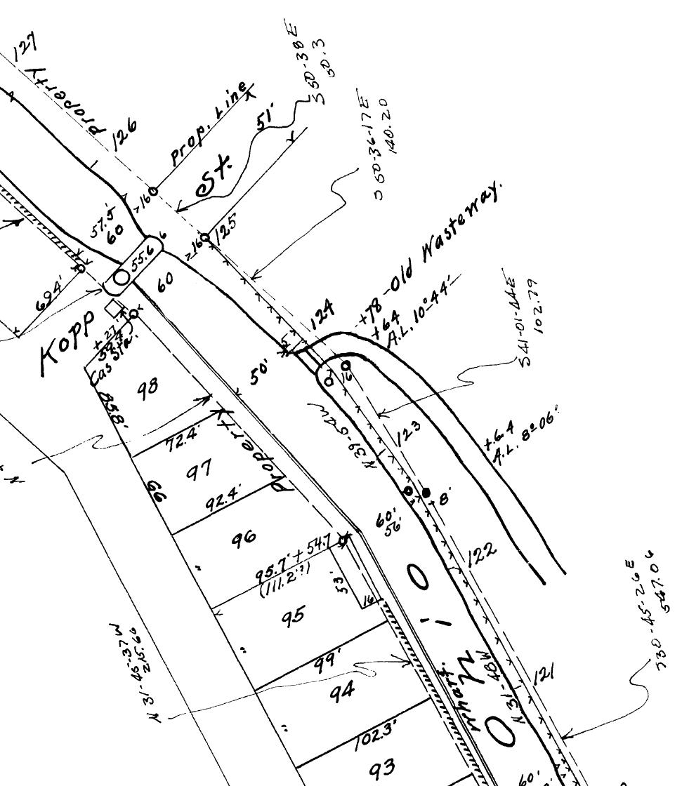
Looking at the first Sanborn Fire Insurance map that shows that area, dated August of 1900 (yet another batch of maps available online from a public source), it shows that and more. The south part of the building(s) is marked as a stable or shed (designated by a large “X” filling the outline) behind a barber shop at 561 North High Street, now a parking lot.

The larger north part is labeled a slaughterhouse, which makes sense with a neighborhood grocery in front at 565 North High Street – currently occupied by All Signs. (That two-story brick building was built anytime after c1875). My 1936 city directory places John O. Knab, grocer, there – appropriate for this German part of town.
The parcel the commercial building and barber shop are on are still defined as one lot – implying the barber shop was rented out while the owner lived above or rented the upstairs apartment, while operating or renting to a business downstairs.
The slaughterhouse would supply meat for a grocery in the commercial space, and the adjacent stable would house horses for their wagon (probably housed in an extension behind the grocery, according to the Sanborn map). The canal would be the dump for the offal from slaughtering – probably just tossed out the rear door visible in the photo!
Oh, and to get even more gross, the ducks would probably enjoy that protein snack.
(Btw, on the mapping, the privy for the complex appears to be a little building in front (west) of the stable, but not visible in the photo…at least that didn’t empty into the canal. Directly.)
The camera was probably aimed across the canal from opposite 555 or 559 North High Street. 555 is now 557, the house in the north side of Springdale Garden Center.
Mistaken Drain
If the photographer continued walking north on the canal towpath after clicking his or her shutter, before getting to Kopp Street s/he would have walked across a short bridge over an “Old Wasteway” shown in 1912 opposite about 579 North High.
This wasteway was a passive overflow for the canal, like that small emergency drain on the back of your bathroom sink – if the water was too high, the excess water would drain out there over a masonry sill (as well as any other location that such drains could have been built). But that’s another story.
…Oh, let’s get into that one:
Where did that wasteway drain to? One map shows a pond in the open field bounded by the school baseball diamond, Back Road, and Yoctangee Parkway / Canal Road.
But that would have drained into that gully between Yoctangee Parkway / Canal Road and the little office building for Chillicothe High School. NO, THAT WAS NOT THE CANAL. It was a natural waterway that was used for canal drainage. Look for yourself on historical maps!!!
Sorry – details, details…
A Picture’s Worth
But this is the delicious amount of information present in photos. I’ve probably spent more than a thousand words just analyzing this one.** (Keep in mind how much information is usually lost when photos are cropped! Ooh, I hate clumsy and unnecessary croppers!)
Take a look at this photo, bland at first glance, when we of the Chillicothe Restoration Foundation put it on display again.
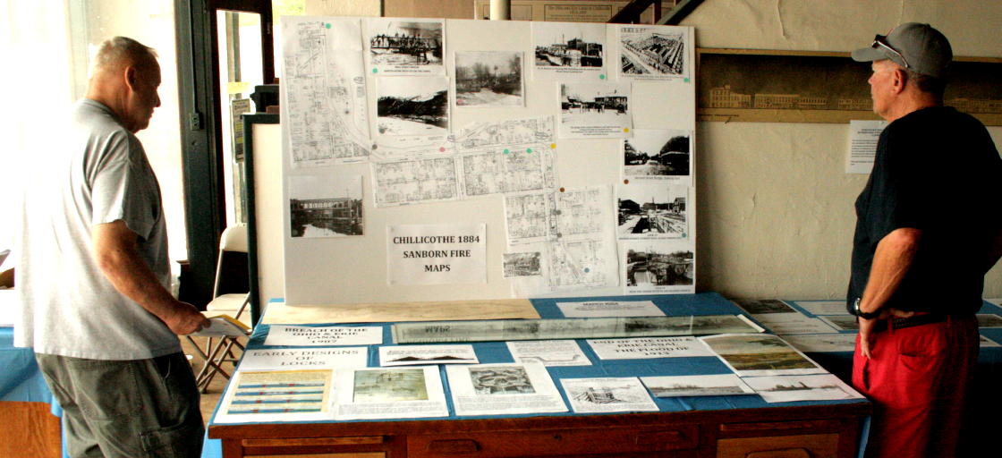
And especially visit the canal photos currently on display at the Pump House. I may even compose a guide or make a presentation on them before they are taken down…after I get medæval!
I am available for similar analysis, description, guidance, photography, research, and conjecture on most aspects of local history or prehistory!
* You can get your own copy of it. The Ross County Historical Society provides prints of their photos for a nominal fee. Most of the photo archive is organized by street or road address, and if not identified, by topic. Call ahead to schedule a visit to the McKell Library.
** 1,989 so far…


Good sleuthing, Sherlock! It was neat to see your path as you followed the clues.
LikeLike
This is the information age – it’s not what you know, but where you can find the information. Likewise, it’s not the solution that is entertaining, it’s the sleuthing (thus Reality Shows). More sleuthing ahead! ; )
LikeLike
Ok, the obsessive editor in me has found a few more tweaks to make, and hyperactively added a few more hyperlinks.
LikeLike
It seems you have discovered the answer to a long time neighborhood misnomer in the High street area. I think you are saying that the long “trench” from the old “railroad tracks” on the North side of City Park, under the Mill street bridge, to the current Water Street embankment was the overflow for the canal. All of us that lived in the area – Chestnut, Mill, Arch – always referred to the East side of the “trench” as the “tow path”. If I’m reading you correctly, you’ve answered a long time question for me.
Another subject! Are you interested in some unique and current pictures from the Circleville portion of the canal and the aqueduct. I took them several (approx. 10) years ago. I would be willing to share them with you!!!
LikeLike
Yup, the gully or trench, from behind the Church of Christ in Christian Union at 477 N. High (the site of a tanyard! Oops, another story…), past the little school office building, under the CHS/CMS bridge, along the playing fields, and under the Mill Street bridge into the park lake, is NOT the canal. It’s a natural drainage that was used for canal overflow, and has been much modified before and since. The actual canal is under Yoctangee Parkway – entirely and exclusively – from Walnut to High.
LikeLike
Sure, Mike – I and others would like to see your Circleville photos. Maybe we can meet and share, or do it online.
LikeLike
We will have to do it online. I live in Amarillo, TX now. My family goes way back in Chillicothe/Old Town (1798) but we retired here at my wife’s hometown. Big (50 yrs)into Genealogy!!Please give me a good e-mail and I’ll send attach.MJA
LikeLike
Good Work, Sherlock!
LikeLike
Thanks. I liked your FB message about enjoying this “Goosetown Barn deduction/deducktion”!
LikeLike
And, thanks – I may be a Sherlock Holmes, but a Sherlock cannot do everything without assistance from various Doctor Watsons!
LikeLike